April 08, 2019
EcoRestore: Restoring California's Great Estuary
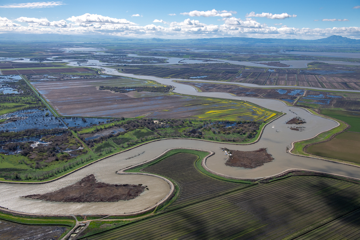
An aerial view of the Delta. DWR/2019
The Sacramento-San Joaquin Delta is the largest estuary on the West Coast. It’s a maze of floodplains, rich farmlands, and leveed waterways that helps provide freshwater to 27 million Californians. For centuries, the Delta was a dynamic and rich ecosystem of tidal wetlands, riparian forests, and vast seasonal floodplains.
But about 98 percent of the native habitat disappeared after the Gold Rush and a population boom across the Golden State. The spike in human development contributed to a decline in native fish, wildlife, and plants. The State of California recognizes the critical need to restore the Delta’s natural habitat and protect water for fish and human uses. In 2015, the California Natural Resources Agency embarked on an initiative to restore 30,000 acres habitat across the Delta.
In 2018, the California EcoRestore initiative broke ground on five habitat restoration projects that create new tidal wetlands, establish new riparian habitat, and improve fish passage through flood infrastructure built over a century ago.
The Department of Water Resources is the lead agency on 28 of 30 EcoRestore projects, including those that launched last year. The ecological restoration of today also supports the modern Delta as a place for people to live, work and play.
EcoRestore is about unifying the partner agencies and organizations involved in Delta environmental restoration, and accelerating results.
Watch the video below to learn more about how EcoRestore projects seek to repopulate salmon, smelt and other endangered species by either improving flood infrastructure or creating sustainable habitats.
February 01, 2019
DWR Gets Fish Friendly with Retooled Infrastructure in Yolo Bypass
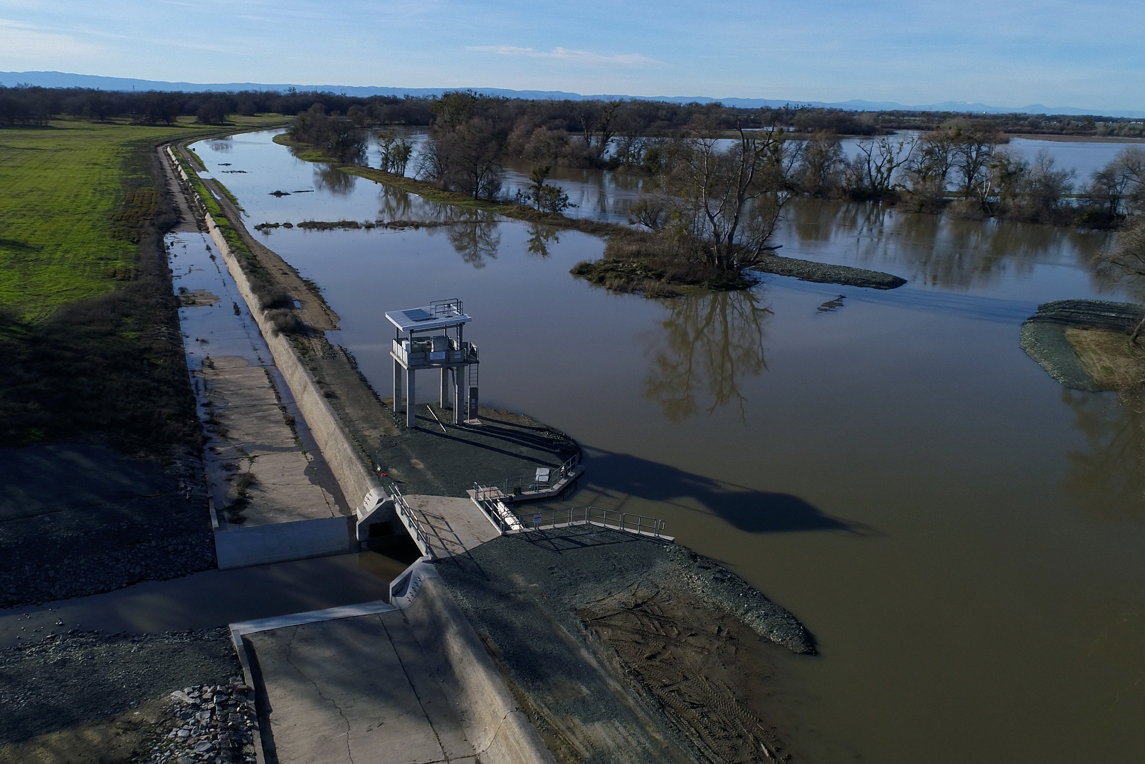
Editor’s note: The following article is part of a continuing series highlighting the California EcoRestore Initiative, which seeks to restore 30,000 acres of habitat in the Sacramento-San Joaquin Delta by 2020. California EcoRestore is an umbrella program that includes habitat restoration efforts implemented and funded by departments under the California Natural Resources Agency including Department of Water Resources, Department of Fish and Wildlife, and Delta Conservancy.
The Sacramento River moves water from Mt. Shasta to the Sacramento-San Joaquin Delta, gathering runoff from the Coastal Range and Sierra Nevada before turning toward Sacramento and joining with the American River. In wetter years, the Sacramento River swells to flood levels and releases water into the Yolo Bypass, a major flood control feature for the Sacramento Valley.
At 59,000 acres, the Yolo Bypass can hold four times the capacity of water as the Sacramento River.
The primary trigger for river releases into the bypass is the Fremont Weir, a 1.8-mile concrete wall that automatically overtops when the Sacramento River reaches a designated high-water mark. Water flows over the weir every two out of three years on average.
Built in 1924 by the U.S. Army Corps of Engineers, the Fremont Weir has been hailed as a simple yet impressive feat in sustainable flood protection and engineering.
What About the Fish?
The weir design, while forward-thinking at the time, revealed unintended consequences over time. Scientists discovered that when the Sacramento River overtopped the weir to flow into the Yolo Bypass, many adult Chinook salmon, steelhead, and sturgeon were delayed or stranded in the bypass.
As the fish, several of which are designated endangered or threatened species, swim north against the river’s current toward their spawning ground, they often mistakenly swim into the Yolo Bypass instead of staying in the river’s main channel. Some fish never make it back to the river. Even if they do, the diversion causes migration delays that may result in fish not spawning that year.
In 1965, the California Department of Fish and Wildlife (CDFW) built a “fish ladder” to help salmon, but over time scientists and engineers found that many fish were still marooned in the bypass. The fish ladder was an insufficient portal to pass through the weir.
A Modern Solution with Multiple Benefits
In 2018, DWR and the U.S. Bureau of Reclamation (Reclamation) updated the fish ladder with a deeper, wider passageway in the weir to facilitate fish passage from the bypass to the river. In designing the Fremont Weir Adult Fish Passage Modification Project, DWR and Reclamation worked with an array of scientists, engineers and landowners from different organizations, including California Trout and American Rivers.
The design features an open channel fishway and a modern gate structure that automatically opens when water overtops at the Fremont Weir.
“The project allows fish to return to the Sacramento River. This connection improves fish passage and reduces the likelihood of fish getting stranded in the Yolo Bypass,” said Manny Bahia, DWR senior water resources engineer.
The passage corridor also accommodates migrating sturgeon, which can grow up to six feet long.
The retrofitted Fremont Weir will begin operations in winter 2019. DWR and Reclamation collaborated on the project in compliance with the 2009 biological opinion from the National Marine Fisheries Service to offset harm to fish populations caused by the State Water Project and Central Valley Project.
“Every adult fish we save helps protect the species. One adult that makes it to the spawning grounds can lay thousands of eggs,” said Karen Enstrom, program manager for the Yolo Bypass Habitat Restoration Branch at the Department of Water Resources.
Beyond flood control and fish habitat, the Yolo Bypass of today provides an array of benefits including waterfowl habitat, agriculture, recreation, and cultural preservation.
The Fremont Weir Adult Fish Passage Modification Project is one of many restoration and infrastructure improvements within the Yolo Bypass aimed at boosting salmon survival rates. Other projects include the Wallace Weir Adult Fish Rescue Facility, the Yolo Bypass Salmonid Habitat Restoration and Fish Passage Project, and the Lower Putah Creek Restoration Project.
Learn more about these projects on our website.
Contact:
Allen Young, Information Officer, Department of Water Resources
916-653-3925 | allen.young@water.ca.gov
Charlotte Biggs, Program Manager, Department of Water Resources
916-651-2997 | charlotte.biggs@water.ca.gov
January 11, 2019
McCormack-Williamson Tract Project Aims to Protect People and Wildlife
Editor’s note: The following article is part of a continuing series highlighting the California EcoRestore Initiative, which seeks to restore 30,000 acres of habitat in the Sacramento-San Joaquin Delta by 2020. California EcoRestore is an umbrella program that includes habitat restoration efforts implemented and funded by departments under the California Natural Resources Agency including Department of Water Resources, Department of Fish and Wildlife, and Delta Conservancy.
Located just south of the confluence of the Cosumnes and Mokelumne Rivers, the McCormack-Williamson Tract is a north Delta island with a long history of flooding. During the highwater events of 2017, water filled the island after the Cosumnes River overtopped the levee on the northeast bank. McCormack’s southern levees held firm, but had the levees broken, water could have rushed toward surrounding islands, potentially inundating private properties.
The Department of Water Resources (DWR), the Nature Conservancy, a conservation group that owns the site, and local, state, and federal partners acted fast: opening notches in levees on the north and south sides of McCormack to allow water to slowly drain off the island.
Once the flood season ended, DWR and its partners pumped the remaining water off the island, and repaired portions of the levees. Nearby landowners worked closely on the project, adding input as to where officials could open the levees.
“Landowners were happy we were able to move quickly and take action,” said Dawit Zeleke, Director of Conservation with The Nature Conservancy.
Breaking Ground
In 2018, DWR and its partners broke ground on a restoration project nearly a decade in the making. The project incorporates some of the fixes and lessons learned from the breaching event in 2017.
The McCormack-Williamson Tract restoration project, a 1,500 acre site, lowers the levees on the north side of the island to allow the river to overtop into the site. On the south side, DWR will alleviate the surge flows that pose a risk to neighbors by opening small holes in the levee. It’s a near replication of the response to the 2017 overtopping event.
2018 saw the completion of construction of a levee to protect existing infrastructure on the site, as well as progress on habitat restoration plans. For the next phase of the project, DWR will strengthen the interior levees and take steps toward opening the site up to tidal flows.
“The aim (of this project) is to restore natural floodplains and tidal marsh habitats, and also to reduce flood risk in the area,” said Anitra Pawley, McCormack-Williamson Tract project lead at DWR. “These are habitats which are very rare in the Delta and have been lost. We can recreate those habitats in this location.”
“We hope the restoration project will provide a tidal habitat for Delta smelt, and a shallow area for giant garter snakes and migratory birds,” she added.
The project brings together the goals of DWR, the Nature Conservancy and Reclamation District 2110 to restore the Delta island while balancing flood protection for neighboring residents.
McCormack-Williamson Tract is located at a higher elevation relative to most of the Delta. If the same project were attempted at a lower elevation, the land would be constantly inundated, a tidal habitat wouldn’t be possible, and fish and wildlife couldn’t adequately recolonize the area.
“The project is kind of a sweet spot in conservation because it has multiple benefits for people and wildlife,” Zeleke said.
Contact:
Allen Young, Information Officer, Department of Water Resources
916-653-3925 | allen.young@water.ca.gov
Dutch Slough Project Creates Richer Habitat for Delta Fish and Wildlife
Editor’s note: The following article is part of a continuing series highlighting the California EcoRestore Initiative, which seeks to restore 30,000 acres of habitat in the Sacramento-San Joaquin Delta by 2020. California EcoRestore is an umbrella program that includes habitat restoration efforts implemented and funded by departments under the California Natural Resources Agency including Department of Water Resources, Department of Fish and Wildlife, and Delta Conservancy.
The Department of Water Resources (DWR) recently broke ground on the Dutch Slough Tidal Restoration Project, the largest tidal wetlands restoration project in the Sacramento-San Joaquin Delta to date. Located on the Delta’s western edge in Contra Costa County, the Dutch Slough project will transform approximately 1,200 acres of former grazing and dairy lands into a rich habitat for fish and wildlife.
Once completed, the project will utilize natural daily tides to allow water to flow in and out, creating a natural tidal wetland that provides a safer environment for salmon, splittail and other endangered fish species.
Historically, the Dutch Slough site was tidal marsh open to the rest of the Delta’s waterways. These wetlands helped support the base of the food chain.
Starting in the early 20th century, the creation of levees blocked off thousands of acres of wetlands from the Delta’s main channels, which diminished food production for fish and wildlife.
“It basically shut the grocery stores for most of the animals, there just wasn’t that much for them to eat anymore,” said Patty Finfrock, DWR Dutch Slough project manager.
Opening up the site to create the tidal wetland helps increase the density of the base of the food chain (such as clams, insects, and single-celled organisms) that support the fish in the main channels of the Delta.
Additionally, baby salmon migrating through the tidal wetlands to the ocean will now have a place to hide from predators and have greater access to food, which will help them grow stronger.
“Hopefully, the baby salmon will see this as a really great neighborhood to grow up in, because it is going to provide the things that they need – enough food to eat, and a safe place to live,” Finfrock said.
The site provides flood protection to surrounding neighborhoods, acting as a buffer against rising sea levels triggered by climate change. The project also includes a 55-acre regional park that will allow visitors to hike, bike, boat, fish, and birdwatch. The project also protects a historical vineyard, a local cultural heritage site that the public will be able to admire as part of the planned regional park.
“We don’t have to just restore habitat and set it aside for nature; we can do it in a way that provides lots of benefits to humans,” said John Cain, Director of Conservation for California Flood Management with American Rivers, a longtime advocate for this effort.
This project was designed to help scientists learn about restoration in the Delta. It will serve as a living laboratory where scientists can advance their understanding about the benefits of tidal habitat at a range of elevations. This knowledge will help inform future restoration projects – making them more cost-effective and ecologically valuable.
Dutch Slough is part of an effort by DWR’s Delta Levee Program, which ensures that there is no net habitat loss in the Delta because of the state’s levee improvement projects. The Dutch Slough Tidal Restoration Project is the result of years of hard work and a dedicated partnership between local, state, and federal agencies to plan and implement. The project is scheduled to be completed in 2021.
Contact:
Allen Young, Information Officer, Department of Water Resources
916-653-3925 | allen.young@water.ca.gov
November 27, 2018
Private sector partnership underlines DWR Flyway Farms restoration project
Editor’s note: The following article is part of a continuing series highlighting the California EcoRestore Initiative, which seeks to restore 30,000 acres of habitat in the Sacramento-San Joaquin Delta by 2020. California EcoRestore is an umbrella program that includes habitat restoration efforts implemented and funded by the Departments under California Natural Resources Agency including Department of Water Resources, Department of Fish and Wildlife, and the Delta Conservancy.
The Department of Water Resources (DWR) completed construction on a 350-acre tidal restoration project at Yolo Flyway Farms on the northwestern edge of the Sacramento-San Joaquin Delta.
The Yolo Flyway Farms Tidal Habitat Restoration project floods grazing land to create a tidal habitat for Delta smelt in the Yolo Bypass, a floodwater diversion zone in Yolo County. The effort was the result of a partnership between DWR and a private landowner for the creation of habitat restoration.
Through a first-of-its-kind agreement, DWR worked with Charles Tyson, the property owner, to develop the 350-acre tidal habitat restoration site. Following project completion, DWR will take ownership of the site and will be responsible for its long-term maintenance and upkeep.
“Individuals and farmers who own land can see an opportunity to enhance the value of their land – that’s very positive and very possible,” Tyson said.
On September 25, DWR breached the levee allowing the land to tidally connect to the toe drain, a narrow channel that connects the Yolo Bypass with the Sacramento River. Tules were then planted along portions of the newly excavated channels, which will create a conducive environment for the production of food for fish as the vegetation breaks down. The food will eventually wash back into the larger channel, boosting salmon survival rates within the Yolo Bypass.
“We’re doing restoration work in this region because it provides food and habitat to support endangered species,” said Bonnie Irving, DWR senior environmental scientist and Yolo Flyway Farms project manager.
“The more food that we can put back in the Delta, the more food we can produce for endangered fish,” Irving said.
The restoration effort is federally required. In 2008, the U.S. Fish and Wildlife Service (USFWS) determined that the pumps, aqueducts and other water infrastructure in California contributed to endangering the existence of the Delta smelt. USFWS mandated that the state of California restore 8,000 acres of tidal habitat in the Delta and Suisun Marsh.
Endangered fish populations continue to decline in the Delta. A 2017 survey by the California Department of Fish and Wildlife (CDFW) found only two Delta smelt after four months of trawling (dragging a fishing net across water).
The restoration project at Yolo Flyway Farms is part of the California EcoRestore Initiative (EcoRestore), a multiagency initiative coordinated by the Natural Resources Agency, which seeks to restore 30,000 acres of land in the Delta by 2020. EcoRestore responds to the 2008 USFWS mandate and other mandates by accelerating the work of 30,000 acres of restoration across the Delta, which will protect the Delta smelt, salmon, and other native species.
EcoRestore, which includes the tidal marsh projects launched by DWR’s Fish Restoration Program to achieve the federal mandate, also involves projects related to floodplain habitat restoration, fish passage, and improving subsided land and carbon sequestration. EcoRestore provides a vehicle to share lessons and other resources across these state-sponsored restoration efforts.
The overarching goal of California EcoRestore, and projects like Yolo Flyway Farms, is to return the natural ecological function to the Delta, the West Coast’s largest estuary that has badly deteriorated under human development.
Contact:
Allen Young, Information Officer, Department of Water Resources
916-653-3925 | allen.young@water.ca.gov
November 15, 2018
Decker Island project restores 140 acres of tidal wetland habitat, aims to boost fish survival rates
Editor’s note: The following article is part of a continuing series highlighting the California EcoRestore Initiative, which seeks to restore 30,000 acres of habitat in the Sacramento-San Joaquin Delta by 2020. California EcoRestore is an umbrella program that includes habitat restoration efforts implemented and funded by the Departments under California Natural Resources Agency including Department of Water Resources, Department of Fish and Wildlife, and the Delta Conservancy.
DWR recently completed construction that transforms an island in the heart of the Sacramento-San Joaquin Delta from a managed leveed site to an open tidal wetland reminiscent of the historical landscape.
Decker Island (Solano County) is located amidst the largest estuary on the West Coast, between freshwater and saltwater, where the endangered Delta smelt are concentrated. Over time, the Delta ecosystem and food web that native fish species depend on has been greatly diminished.
The Decker Island Tidal Habitat Restoration Project, which broke ground in August 2018, converts an existing wetland into tidal habitat. Under the plan, DWR breached levees along the perimeter of the 140-acre site, allowing water from the Sacramento River to move through the marshland. As the water flows out of the marshland, it carries microscopic plankton, plant particles, and other nutrients across the Delta’s waterways, where the tiny bits are eaten by Delta smelt and other fish and wildlife species.
“These tidal wetlands are the bread baskets of the Delta. This is where the basis of the food web is created,” said Dennis McEwan, Chief of the State Water Project Mitigation and Restoration Branch within DWR.
More than a century ago, levee systems were built up to protect agricultural land and urban areas from the seasonal and tidal waters. Since the 1800s, tidal wetland habitat in the Delta has declined from an estimated 350,000 acres to about only 10,000 acres. This loss of habitat has contributed to the steep decline of native fish and wildlife species. The restoration projects under California EcoRestore, such as this effort on Decker Island, seek to reverse this trend by providing the habitat and food sources needed to boost fish survival rates.
Decker Island is one of 13 projects planned and implemented by DWR’s Fish Restoration Program charged with restoring 8,000 acres of tidal wetland habitat in the Delta and Suisun Marsh, as required mitigation for the State Water Project and Central Valley Project long term operations. This effort has been a close partnership between DWR and the California Department of Fish and Wildlife (CDFW). CDFW will carry out the on-site biological monitoring to ensure the site functions as it was designed and to inform future restoration efforts.
Contact:
Allen Young, Information Officer, Department of Water Resources
916-653-3925 | allen.young@water.ca.gov
October 17, 2018
Largest tidal habitat restoration effort in the Delta breaks ground
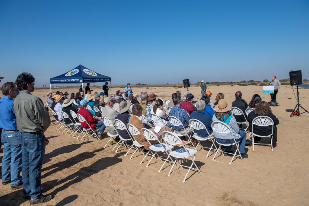
The Department of Water Resources (DWR), along with state and local partners, today celebrated the groundbreaking of the Delta’s largest tidal wetlands restoration project. The Dutch Slough Tidal Restoration Project will re-establish a rich ecological network that will boost survival rates of endangered fish and wildlife while also protecting neighborhoods against flooding.
“We’re advancing scientific knowledge of the Delta and preserving fish and wildlife harmed by decades of land and levee development,” DWR Deputy Director Kristopher Tjernell said at today’s event in Oakley. “This project is good for fish and wildlife. It’s good for water and air quality, and for the state of California.”
Located on the Delta’s western edge, the Dutch Slough Tidal Marsh Restoration Project will transform 1,187 acres of a former grazing area into a rich habitat for fish and wildlife. The project is part of the California EcoRestore Initiative, a multi-agency endeavor to restore more than 30,000 acres of wildlife habitat in the Delta by 2020. California EcoRestore marks the Delta’s largest-ever restoration program.
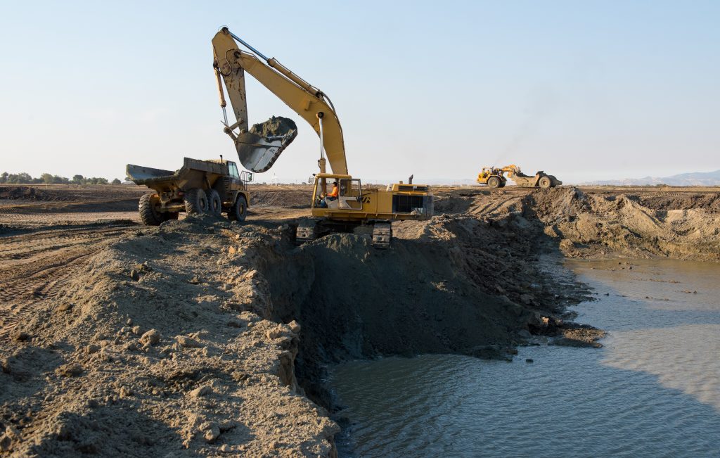
Tidal marsh elevation requires land that gradually slopes upward. In May 2018, DWR began moving dirt from higher elevations to lower elevations, so that water can eventually flow in from the Delta channels and out with the daily tides. The project is expected to be completed once the levees are breached in 2021, and native fish and wildlife can populate the area.
Once completed, Dutch Slough will serve as a regional park with hiking and bike trails. Visitors will be able to learn about biology and history through interpretive signs. This vast marshland will take visitors back in time, to a vibrant ecological wetland reminiscent of the Delta of the early 1800s. The site will also provide flood protection to nearby housing, guarding against rising sea levels triggered by climate change.
Tjernell hailed Dutch Slough as a “living laboratory” because the tidal marsh will inform generations of scientific study and adaptive wetland management in California. Environmental stewardship drives every major decision at DWR, the deputy director noted. In the coming years, the department must prepare for increasing hazards of climate change while ensuring a reliable supply of clean water for 27 million Californians.
Located on the west side of the Delta near the confluence of the Sacramento and San Joaquin rivers, Dutch Slough is close to the Suisun Marsh estuary where salt water mixes with fresh water, creating an environmentally rich and varied habitat compared to other marsh sites. The transformation of retired agricultural land into tidal marsh will create a mostly predator-free space for juvenile salmon and other species in decline.
“It’s essentially a safe neighborhood for fish,” said Patty Finfrock, DWR’s project manager for Dutch Slough. “The salmon breed upstream, and their young will swim downstream and find plenty of food and shelter.”
John Cain, Director of Conservation for California Flood Management at American Rivers discovered the ecological possibility of the site in 1999 and convinced local leaders that tidal marsh was the best use for the site. “We made the case that this was the best way to preserve the Delta shoreline while being able to provide access for people to walk along trails and to safely boat and fish,” Cain said.
More information:
+ Visit DWR’s Dutch Slough web page.
Read more about the event and project:
San Francisco Chronicle, Marsh project means more fish, birds and wildlife
East Bay Times, Delta’s largest wetlands restoration project kicks off in Oakley
Brentwood Press, [Video] Dutch Slough project groundbreaking
May 30, 2018
Historic Groundbreaking of Project to Secure Fish Passage in the Yolo Bypass
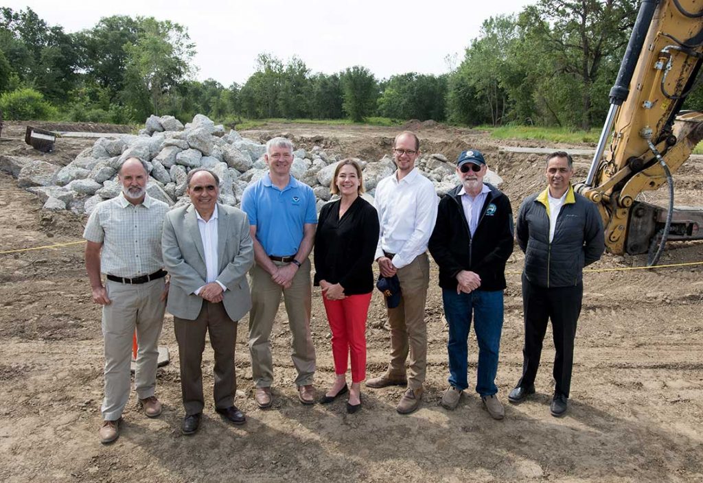
John Cain, Director of Conservation for CA Flood Management, American Rivers
Jim Provenza, Yolo County Supervisor
Barry Thom, Regional Administrator, NOAA Fisheries
Karla Nemeth, Director, Department of Water Resources
Kris Tjernell, Deputy Director, Department of Water Resources
John Laird, Secretary, California Natural Resources Agency
David Murillo, Regional Director, U.S. Bureau of Reclamation
California EcoRestore celebrated its third birthday by breaking ground on an important project that will remove barriers for adult fish traveling through the Yolo Bypass to their spawning grounds in the Upper Sacramento River and its tributaries. For many of the more than 100 attendees, this day was years in the making, for others, an opportunity to learn more about this pivotal effort. Representing a partnership between the federal, state and local government and the environmental community, the May 30th groundbreaking ceremony for the Fremont Weir Adult Fish Passage Modification Project is a true testament to the importance of persistence and the value of multi-agency collaboration when working toward a common goal.
At the ceremony, US Bureau of Reclamation (Reclamation) Regional Director, David Murillo reflected on the collaborative nature of the project, “Fremont Weir is a prime example of what we can do when state and federal partners work together for water supply reliability in California.” Reclamation and the CA Department of Water Resources (DWR) are the lead agencies implementing the effort.
DWR Director, Karla Nemeth provided a broader content for the impacts to the ecosystem of habitat restoration projects in the Yolo Bypass, Delta and Suisun Marsh region, “All of these pieces start to become a reality and we can see the ways in which we can reconnect very important watershed systems at the landscape scale.”
The 1.8 mile-long concrete weir, originally completed in 1924, and fish ladder, subsequently constructed in 1965, sit along the backdrop of the Sacramento River in the northern Yolo Bypass, an ancient and critical fish migration corridor. Over time, floodplain habitats in the region have been diminished, disconnecting anadromous adult fish from their spawning grounds. Several structures in the Yolo Bypass, including the Fremont Weir, are a documented source of migratory delay and stranding that often prevent adult fish from completing their migration from the ocean to their spawning grounds upstream. Additionally, the current fish ladder provides insufficient passage for adult salmon and does not provide passage for adult sturgeon.
The Fremont Weir Adult Fish Passage Project will enlarge the existing fish ladder, improving the connection to the Sacramento River, which will give fish more time to reach the northern Yolo Bypass. It will also make it easier for fish to locate the much larger fish passage structure and exit the Yolo Bypass to return to the Sacramento River, and remove or replace earthen agricultural road crossings to provide unimpeded movement in the area, allowing migrating fish to ultimately reach their spawning areas or return to the Delta.
Project construction is expected to be completed in 2018, paving the way for additional fish passage improvement projects in the Yolo Bypass.
Additional Information:
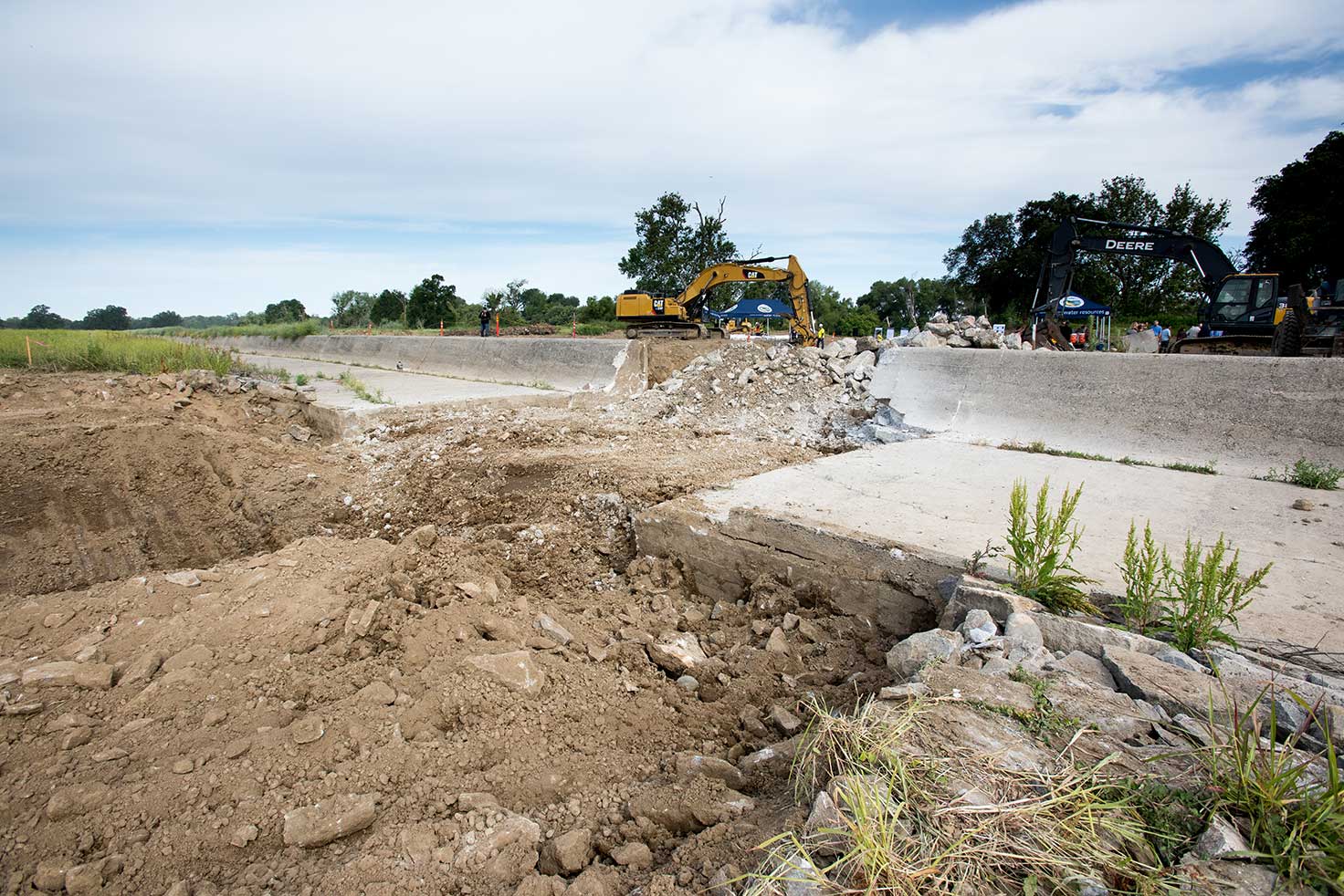
Photo 2: Demolition of the old fish ladder at the Fremont Weir began May 29, 2018. Photo courtesy of Department of Water Resources (Kelly M. Grow)
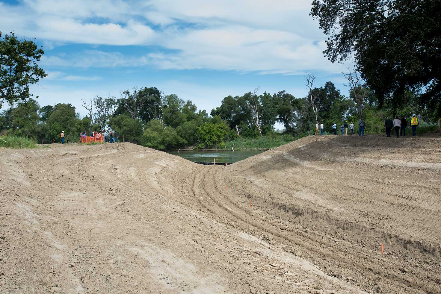
Photo 1: The newly excavated channel from the Sacramento River to the Fremont Weir and the upgraded fish passage structure. Photo courtesy of Department of Water Resources (Kelly M. Grow)
May 9, 2017
Levee Improvement, Floodplain and Habitat Restoration Effort Underway in West Sacramento
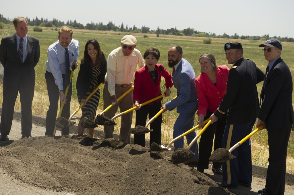
State, Local and Federal partners initiate the Southport Levee Improvement Project with the traditional groundbreaking ceremony in West Sacramento, California. Left to right: Gary Bardini, Deputy Director, California Department of Water Resources; Mark Johannessen, West Sacramento Mayor Pro Tem; Quirina Orozco, West Sacramento City Council; Bill Denton, WSAFCA Board President; Congresswoman Doris Matsui; Christopher Cabaldon, Mayor of West Sacramento; Babs Sandeen, West Sacramento City Council; Colonel David G. Ray, U.S. Army Corp of Engineers, Sacramento District Engineer; Clyde MacDonald, Central Valley Flood Protection Board.
The City of West Sacramento, along with local, state and federal officials, broke ground on its largest levee improvement project to date on Tuesday, May 9, 2017. Congresswoman Doris Matsui and West Sacramento Mayor, Christopher Cabaldon, along with various flood protection partners, spoke to a crowd of more than 75 people at the Southport Levee Improvement Project site to celebrate the official start of construction on the project aimed at improving nearly six miles of vulnerable levee in this urban area. As Mayor Cabaldon explained, the project will offer multiple benefits including increasing flood protection, habitat restoration and creation of recreational trails. The project includes the setback of the existing levee to provide additional flood capacity and create mixed floodplain and riparian habitat to provide benefits to native fish species, and contributes to California EcoRestore floodplain and riparian habitat restoration targets in the Delta. This multi-benefit flood and ecosystem enhancement effort is one of four projects aimed at bringing West Sacramento up to the state-mandated 200-year flood protection level.
The project was planned and permitted through a partnership between the City of West Sacramento, West Sacramento Area Flood Control Agency, California Department of Water Resources (DWR), Central Valley Flood Protection Board, and U.S. Army Corps of Engineers. Speakers at the event emphasized the project would not have been possible without the strong partnership among the agencies involved. Congresswoman Matsui thanked the project partners for their support, including the State and DWR, who contributed proposition funding to assist with early implementation and habitat restoration efforts.
Read more about the event:
October 6, 2016
Project Underway at Wallace Weir to Protect Migratory Salmon
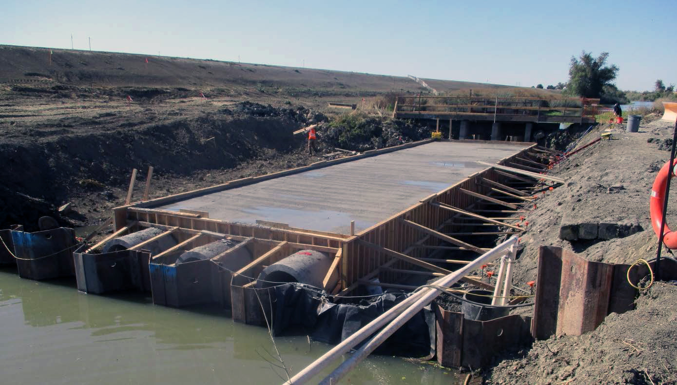
Local, state, and federal officials gathered Thursday, October 6th to celebrate the construction underway at the Wallace Weir Fish Rescue project aimed at addressing a well-known hazard to migratory Sacramento River salmon. This project is building a permanent, fish-friendly weir in the Yolo Bypass four miles northeast of Woodland to help prevent adult Sacramento River salmon from swimming into a drainage ditch that leads deep into farm fields providing no spawning potential. By building a permanent barrier across the Knights Landing Ridge Cut, the agencies will be able to better control farm drainage releases to avoid attracting salmon. A new fish collection facility adjacent to the weir will allow the California Department of Fish and Wildlife to more effectively capture stray salmon and return them to the river to spawn.
The Wallace Weir Fish Rescue reconstruction project is being managed by Reclamation District 108, while the $13 million cost of the project is being paid by the customers of the State Water Project, operated by the state Department of Water Resources, and the Central Valley Project, operated by the U.S. Bureau of Reclamation. The Wallace Weir Fish Rescue project is required by the National Marine Fisheries Services in their 2009 Biological Opinion protecting chinook salmon under the U.S. Endangered Species Act.
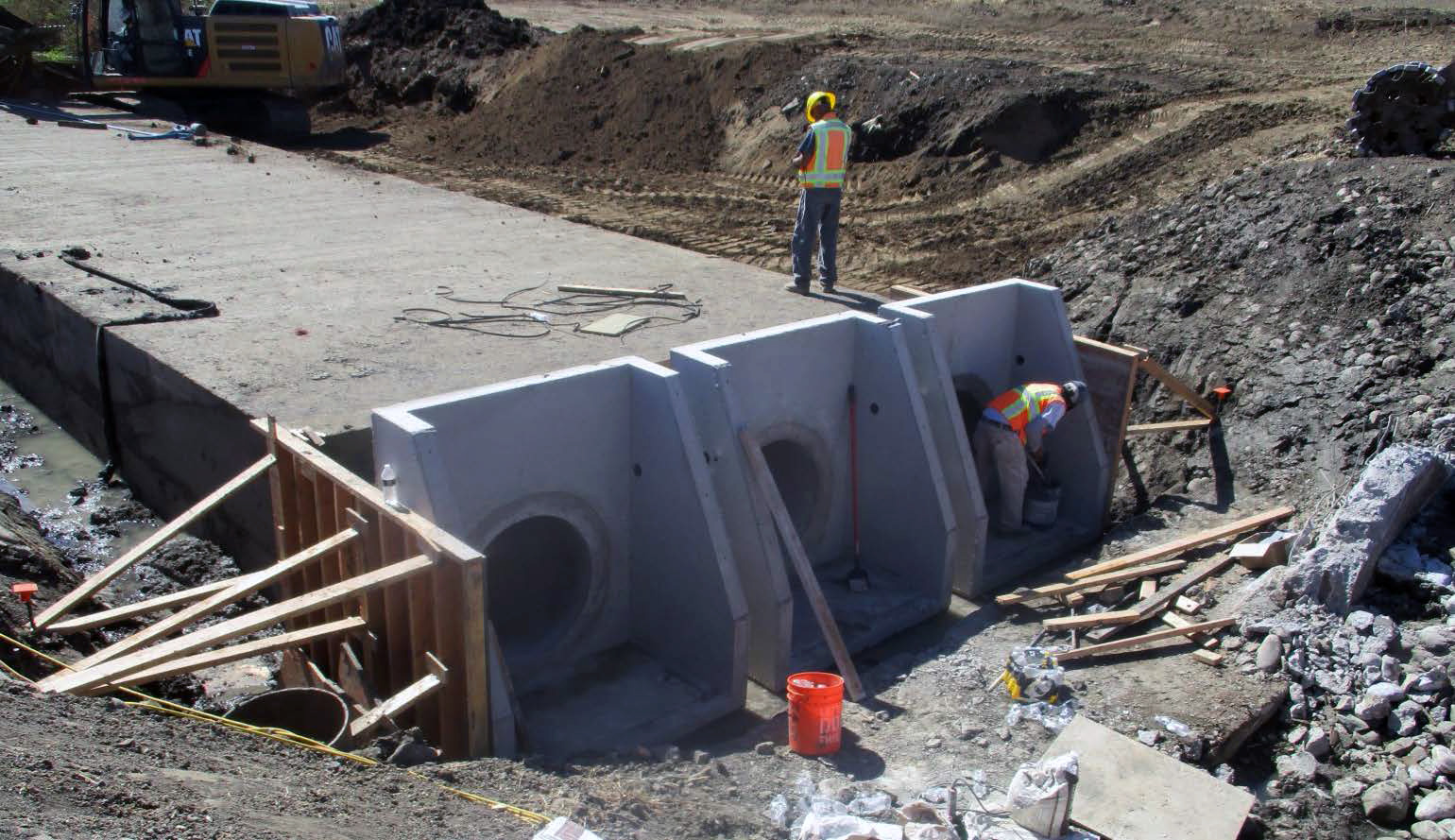
“The new permanent Wallace Weir and fish collection facility will allow hundreds of additional adult salmon to reach their spawning grounds, including critically endangered Sacramento River winter-run Chinook salmon,” said Maria Rea, Assistant Regional Administrator for NOAA Fisheries California Central Valley Office.
Fritz Durst, president of Reclamation District 108 board, told the crowd gathered at the Wallace Weir site during the October 6 ceremony, “We, as farmers, like to get stuff done” praising the “fix-it versus fight attitude” in the Sacramento Valley, adding that “We are fortunate to have a group of doers here.”
4th District Assemblyman Bill Dodd also praised the progress on the project, noting, “I constantly hear from constituents who worry about fish and who worry about water,” explaining that finding the balance of both will not be easy.
Reclamation District 108 general manager Lewis Bair echoed the messages of both Durst and Dodd when he said, “There is growing hope in our community that hard work and strong partnerships will bring sustainability to both California’s fish and farms.”
Reclamation District 108 hopes to finish the Wallace Weir project this winter. The permanent structure involves a new earthen weir hardened to withstand floods, as well as operated water control gates and an adjacent fish collection facility.
Mark Cowin, Director, Department of Water Resources, discusses the multiple benefits of the Wallace Weir Project and lauds cooperation in the Sacramento Valley.
Curtis Knight, Executive Director, California Trout, speaks at the Wallace Weir media event.
September 19, 2016
Tule Red Tidal Wetlands Restoration Project
Local, state, federal, and private industry leaders on Monday, September 19, 2016 kicked off the largest tidal wetland restoration project in the Delta, breaking ground on a project to return salty tides to several hundred acres for the sake of native fish.
More than a century after people built earthen dikes to block off part of Suisun Marsh to create duck hunting clubs, the Tule Red project in Solano County would open more than 400 acres of wetlands to daily tides. With reworked berms and new channels and basins, the project will create habitat to harbor and boost food production for several threatened or endangered species including the Delta smelt, longfin smelt, and chinook salmon.
Public water districts around California that depend upon the delivery of water from the Delta will pay for the project. Under directives from the U.S. Fish and Wildlife Service and the California Department of Fish and Wildlife, the California Department of Water Resources is obligated to restore 8,000 acres of tidal wetlands in the Sacramento-San Joaquin Delta and 800 acres of tidal wetlands in or around the Suisun Marsh. The Department of Water Resources (DWR) owns and operates the State Water Project.
“Human intervention altered the Delta profoundly over the last 150 years, and with projects like Tule Red, we can intervene to turn back the clock,” said California Natural Resources Secretary John Laird. “When we welcome tides back to a few hundred acres of Suisun Marsh, we reverse the trends that eliminated 95 percent of the tidal wetlands in the Bay-Delta, the largest estuary in the Western Hemisphere.”
Commonly known as the Tule Red Hunting Club, the 420-acre duck club is located along Grizzly Bay in Suisun Marsh. Before it was diked to create fresh and brackish water habitat favored by game ducks in the early 1900′s, this property was tidal habitat, with seasonal fresh water inundation during wet winter periods. The Suisun Marsh, south of Fairfield, is the largest contiguous brackish water marsh on the west coast of North America. The 116,000-acre marsh represents more than 10 percent of the remaining natural wetlands area in the state.
The Tule Red project will involve breaching a natural berm to allow for full daily tidal exchange through the interior of the project site and creation of a network of channels to convey water across the marsh plain. The project is designed to not only provide habitat to Delta smelt, longfin smelt, salmonids, and other native fishes, but also to reestablish important ecological processes that will maximize production of the microscopic plants and animals at the base of the food web that nourish native fish. One of the factors that has led to the precipitous decline of Delta smelt and other native species is lack of food resources.
DWR’s video from groundbreaking ceremony and highlights from key speakers:
October 22, 2015
Knights Landing Outfall Gates Fish Passage Improvement Effort
Local, state, federal, and private leaders gathered on October 22, 2015 for a dedication ceremony for a project to benefit native fish species migration by implementing a fish passage improvement to prevent salmon entry into the Colusa Basin Drain (CBD) while also maintaining outflows and appropriate water surface elevations. The Knights Landing Outfall Gates (KLOG) project consists of constructing a positive fish barrier on the downstream side of the existing KLOG structure to prevent adult salmon entry into the CBD, as well as repairing an erosion site on the right bank of the CBD on the downstream side of the KLOG structure. This effort is aimed at addressing a known salmon migration issue – currently, when salmon enter the CBD, there is no upstream route for salmon to return to the Sacramento River and, absent fish rescue operations, the fish perish and are lost from production. The KLOG structure is located on the CBD, approximately one-quarter mile from its confluence with the Sacramento River near the community of Knights Landing, just below River Mile 90, in Yolo County. Reclamation District (RD 108) acted as the California Environmental Quality Act (CEQA) lead agency.
DWR’s video from the ceremony and highlights from key speakers:

