Science guides how we protect our environment across California and help people and nature thrive together. At the California Natural Resources Agency, we’re committed to making decisions based on the best available science. Science helps us protect our communities from catastrophic wildfire, adapt our water systems to the changing climate, transition to a clean and abundant energy future, and support healthy ecosystems and natural resources. Scientific information and data provide an essential foundation for learning, action, and innovation that benefits our state and its people.
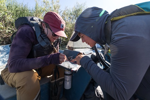
Often the most impactful science happens when experts from different institutions and disciplines work together. That’s why scientific partnerships are so important. We engage with researchers from universities and national laboratories, tribal knowledge holders, land managers, and community members to use the best available science to generate actionable insights, data, and tools we need to manage California’s natural resources.
Our most successful scientific partnerships span a broad set of topics, including:
- Biodiversity
- Coast & Ocean
- Energy
- Water
- Wildfire
For questions or input regarding science at our agency, contact our Science Advisor. We are proud to share summaries of our ongoing science partnerships below.
California Bat Population Monitoring, White-nose Syndrome Surveillance, and Outreach
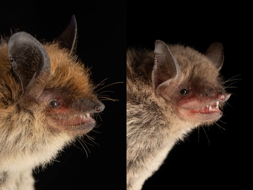 The California Bat Population Monitoring, White-nose Syndrome Surveillance, and Outreach partnership protects California’s bat biodiversity by addressing white-nose syndrome (WNS), a deadly fungal disease that affects hibernating bats. Since its emergence in 2006, WNS has caused 90% population declines of three bat species in the eastern U.S., which led to listing under the Endangered Species Act. This partnership supports population monitoring, disease surveillance, and outreach efforts to fill critical knowledge gaps and inform management actions. It includes California Department of Fish and Wildlife’s Wildlife Diversity Program, Health Lab, and Genetics Lab, the California Department of Conservation Abandoned Mine Lands Unit, U.S. Fish and Wildlife Service National and Regional WNS Coordination Teams, and National Park Service Inventory and Monitoring Programs. Over the past 10 years, this partnership has resulted in disease surveillance of more than 4,000 bats from nearly 50 sites in 21 counties across the state. Monitoring is crucial, as the causative fungus has been detected on susceptible bat species in five counties—signaling a serious risk to the state’s hibernating bat populations. Bats are essential in ecosystems and provide crucial pest control services, saving farmers in the U.S. over $3 billion annually in pest control. For more information, reach out to Katrina Smith at katrina.smith@wildlife.ca.gov
California Biodiversity Data Exchange (CalBioDEx)
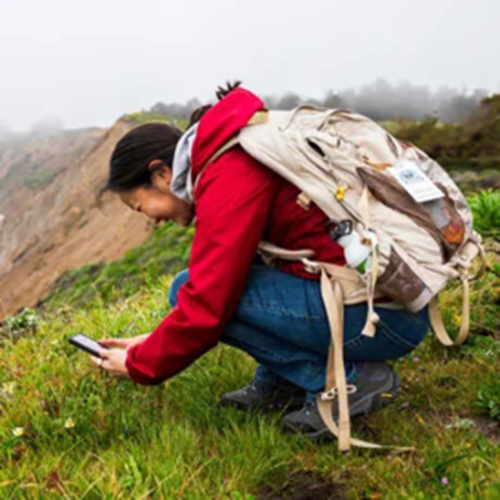
The California Biodiversity Data Exchange (CalBioDEx) is a new partnership between California Academy of Sciences, the California Department of Fish and Wildlife, and iNaturalist to share data records of California's most imperiled species. Sightings and records of these species within iNaturalist's database will now be available for incorporation into the state’s species data repository, the California Natural Diversity Database, thereby making this information available to numerous entities to help with conservation and planning efforts. Since data collected on iNaturalist is community-collected data, there are huge amounts of data for conservation experts to use - California has about 21 million iNaturalist records alone. This new partnership and the resulting data sharing provides further information on where imperiled species are located and what can be done to properly protect them. For more information on CalBioDex, reach out to Carie Battistone at carie.battistone@wildlife.ca.gov or view CalBioDEx's information page here.
Oiled Wildlife Care Network
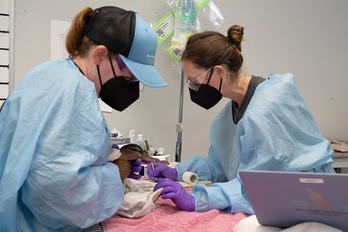
The Oiled Wildlife Care Network (OWCN) is a statewide collective of trained wildlife care providers, regulatory agencies, academic institutions and wildlife organizations working to rescue and rehabilitate oiled wildlife in California. The CDFW's Office of Spill Prevention and Response (OSPR) leads the wildlife response during oil spills; and the OWCN and their 45 member organizations throughout the state deploy immediately to conduct wildlife capture and care operations. Together, OSPR and OWCN have developed crucial response protocols for animal rehabilitation. Through their 12 permanent wildlife rehabilitation facilities, the OWCN has helped in more than 75 spills impacting wildlife and has rehabilitated over 10,000 animals. For more information contact Greg McGowan at greg.mcgowan@wildlife.ca.gov.
Sentinel Sites for Nature
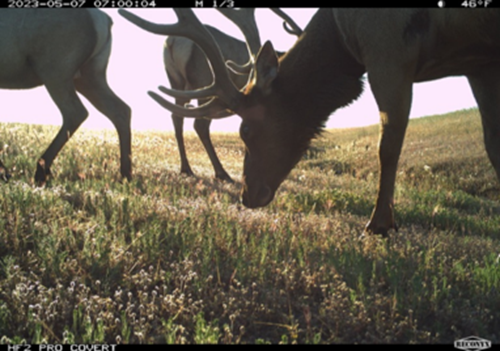
California Sentinel Sites for Nature is a statewide network of monitoring sites to observe and assess California's climate and biodiversity over time. The California Sentinel Sites for Nature collaborative is led by CDFW and UC Nature and supported by the California Biodiversity Network, universities, government agencies, and private entities with expertise in conservation. Through a combination of cameras, audio recorders, and radio telemetry, animal presence is being documented at Sentinel Sites to understand how wildlife is being impacted by climate change and other stressors across the state. Sentinel Sites provide standardized long-term data that guide California's conservation efforts to protect its diverse wildlife and ecosystems. These sites also provide real-time data and act as an early warning system for emerging conservation issues. To learn more, join a roundtable hosted by the California Biodiversity Network, or contact Whitney Albright at whitney.albright@wildlife.ca.gov.
COAST State Science Information Needs Program: Wildfire Impacts on Coastal Ecosystems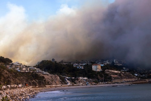
The COAST State Science Information Needs Program is a research solicitation program that aims to advance research on the impacts wildfires have on coastlines. Wildfires impact coastlines by changing water quality and introducing new debris into river flow. Research on how to best address these changes and make coastlines more resilient is crucial as California experiences more frequent and severe fires. The data from this research will be used in land management decisions, landscape restoration programs, and funding decisions. COAST is partnered with the Coastal Conservancy and the California State University. For more information, reach out to Evyan Borgnis Sloane at evyan.sloane@scc.ca.gov.
Regionally Advancing Living Shorelines & Building Capacity for Coastal Climate Resiliency in San Francisco Bay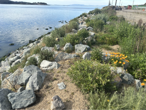
Regionally Advancing Living Shorelines and Building Capacity for Coastal Climate Resiliency are two related projects that aim to protect and improve nature-based climate adaptation in the San Francisco Bay. These projects are led by the State Coastal Conservancy, in partnership with the San Francisco Estuary Institute, Estuary and Ocean Science Center, and many others. Both efforts are building capacity and developing resources to transfer knowledge, increase uptake and scale up implementation of living shoreline projects in the San Francisco Bay. Living shorelines are nature-based solutions that use local habitat approaches including nearshore reefs, eelgrass and seaweed restoration, rocky intertidal and coarse beach approaches, and other green and green-grey methods to protect shorelines from erosion and future sea level rise. These pilot projects are advancing innovative multi-benefit projects that increase biodiversity and habitat connectivity, protect shorelines from wave energy and erosion, and benefit local fish and wildlife. Golden Gate Bird Alliance, Marin Audubon Society, Ducks Unlimited, Port of San Francisco, East Bay Regional Park District, and many other local, state, and federal partners are also collaborators. For more information, contact Marilyn Latta at marilyn.latta@scc.ca.gov.
Carbon Sequestration, Regional Technical Partnership
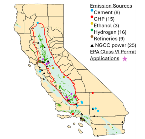
The CalCCS project is one of 9 projects selected by the U.S. Department of Energy’s Regional Initiative for Technical Assistance Partnerships (RITAP) program and once fully awarded, will provide technical assistance to carbon capture and storage projects in the Central Valley Basin. CNRA is a member of the CalCCS project team. Carbon capture and storage projects take carbon dioxide from emissions streams of power or industrial facilities or directly from the air and store it long-term in geologic formations to mitigate future climate change. Such carbon capture and storage projects will help California meet its carbon neutrality goals. For more information, please see the DOE announcement or reach out to Sarah Saltzer at sarah.saltzer@stanford.edu.
Cooking Energy and Ventilation Impacts on Children's Asthma (CEVICA)
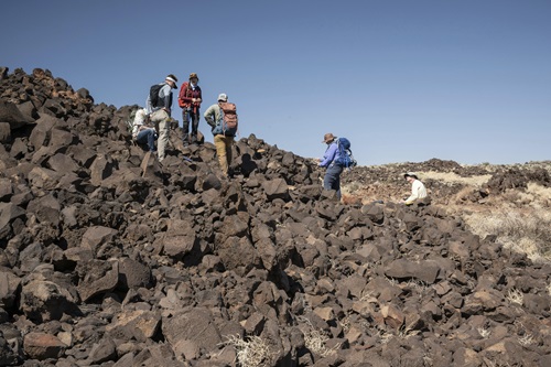
Mapping project provides high-quality data of the surface and subsurface of the United States. This project maps the locations of critical minerals and builds upon Earth MRI, a U.S. Geological Survey initiative that collects geophysical, geological, and geochemical data nationwide. Diverse datasets are collected from multiple sources and at multiple scales to locate important mineral resources, building materials, groundwater, and locations of possible geological hazards. This data is beneficial for critical mineral supply chains and emergency response planning decisions. Earth MRI brings the United States' geological data up to modern, international standards and encourages future innovation in the field. For more information, reach out to Jamey Jones at jvjones@usgs.gov.
Critical Minerals Identification and Mapping

The Cooking Energy and Ventilation Impacts on Children with Asthma (CEVICA) study is a multi-institutional research partnership investigating how replacing natural gas cooking with electric cooking affects indoor air quality and respiratory health in homes of children with asthma. Supported by the California Energy Commission through the Electric Program Investment Charge (EPIC) Program—funded by California utility customers under the auspices of the California Public Utilities Commission—the study involves collaboration with the Central California Asthma Collaborative (CCAC), the Association for Energy Affordability, the University of California, San Francisco, the University of California, Los Angeles, the University of California, Berkeley and other partners. By leveraging CCAC's trusted relationships in San Joaquin valley communities and conducting in-home research through its existing asthma program, the partnership has enabled a rigorous randomized controlled study of children in the Medi-Cal system. The findings will help inform California policies and programs related to residential cooking energy, indoor air quality, and health. For more information, contact Dr. Maninder Thind at maninder.thind@energy.ca.gov.
Project Nexus - Turlock Irrigation District Canals
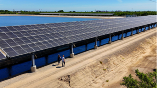
Project Nexus is a pilot initiative that installed solar panel canopies over irrigation canals in the Turlock Irrigation District (TID). Based on a UC Merced study, these canopies could generate renewable energy while simultaneously conserving water- potentially saving up to 63 billion gallons of water annually. Project Nexus is a collaborative initiative of the University of California Merced, Solar AquaGrid, the California Department of Water Resources, and the Turlock Irrigation District. These solar canopies have the potential to reduce water evaporation from canals, efficiently generate renewable power, and save millions in future maintenance costs. Find contact information on TID‘s Project Nexus homepage and view the project’s video overview here.
California DWR-CW3E Research and Operations Partnership
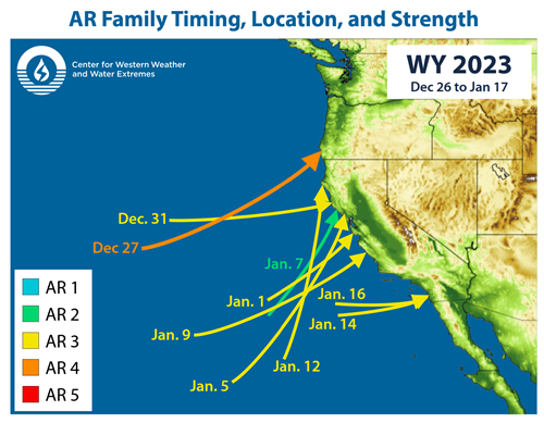
The California DWR-CW3E Partnership is a research and operations partnership within the Center for Western Weather and Extreme Events. This partnership focuses on innovations in weather and watershed observations and forecasts associated with atmospheric rivers along the West Coast. The DWR-CW3E partnership enables research to address key knowledge gaps that impact California’s ability to manage the wild swings between too much and too little water. The ability to simultaneously mitigate flood hazard while improving water supply reliability greatly enhances California’s resilience to climate change. This partnership also improves coordination of flexible reservoir operations and enhancement of groundwater recharge using flood waters. Forecasting the timing, pace, and scale of extreme events is essential for emergency response plans and informing long-term water infrastructure, like hydropower and reservoir management. This long-term partnership is supported by UC San Diego, the Scripps Institute of Oceanography, NOAA, DWR, and the US Army Corps of Engineers. For more information, reach out to Michael Anderson at Michael.L.Anderson@water.ca.gov.
Klamath River Technical Team
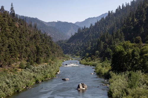
The Klamath River Technical Team is an ad-hoc team that meets annually to determine essential abundance estimates of Klamath River Fall Chinook Salmon returning to the Klamath River. These estimates include fish harvest and escapement- the total number of adult fish that return to river spawning grounds and hatcheries from the ocean. These estimates are crucial for setting future fishing limits and making sure fish populations stay stable. This team is supported by multiple state and federal grants and includes the CDFW, Hoopa Valley Tribe, Yurok Tribe, The Klamath Tribes, NOAA, United States Fish and Wildlife Service, United States Forest Service, Oregon Department of Fish and Wildlife and CalTrout. Reach out to Morgan Knechtle at morgan.knechtle@wildlife.ca.gov for more information.
Interagency Ecological Program
The Interagency Ecological Program (IEP) is a partnership that started in 1970 to serve as a hub of collaborative aquatic science network with a focus on the San-Francisco Bay-Delta. The IEP works to improve the ecological understanding of San Francisco Estuary while supporting synthesis and information needs for State Water Project and Central Valley Project management. DWR and Reclamation, in collaboration with other IEP member agencies such as CDFW, coordinate monitoring and science activities to meet Endangered Species Act and Water Right permitting requirements. For more information, reach out to Karen Gehrts at Karen.Gehrts@water.ca.gov.
Pyregence Consortium
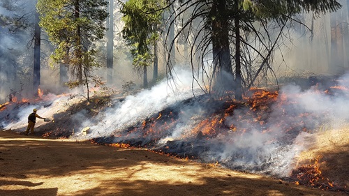
The Pyregence Consortium is a California-based research collaboration that brings together universities, public agencies, nonprofits, and private industries to advance wildfire science. By building a coordinated scientific community, the Consortium produces innovative wildfire research beyond the capacity of a single research institution. Based in open-science principles, its work is collaboratively developed and made openly available, including fire and vegetation models that project wildfire behavior and landscape change. The Consortium’s tools and research support wildfire resilience solutions for emergency planning, land planners, the public, researchers, and policy makers. Reach out to Shane Romsos at sromsos@sig-gis.com or David Saah at dsaah@sig-gis.com for more information. For more information, visit https://www.pyregence.org/.
WERK
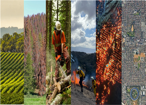
The Wildfire, Ecosystem Resilience, and Risk Assessment Initiative (WERK) is a collaborative partnership between the California Natural Resources Agency (CNRA), the California Air Resources Board (CARB), and NASA Ames Research Center, established to co-develop actionable, updatable, and freely accessible Earth observation data products for monitoring California’s diverse ecosystems. WERK integrates satellite remote sensing, airborne observations, data-driven modeling and advanced geospatial analytics to provide statewide assessments of ecological condition and change, as well as the effectiveness of land management actions across California’s natural and working lands. The initiative is designed to support California’s urgent need to track landscape changes caused by wildfire and other environmental disturbances while enabling science-based decision-making for wildfire resilience, ecosystem restoration, and long-term natural resource planning. For more information, contact Loretta Moreno Loretta.Moreno@resources.ca.gov or Matthew Johnson

