
Flood-Managed Aquifer Recharge (Flood-MAR)
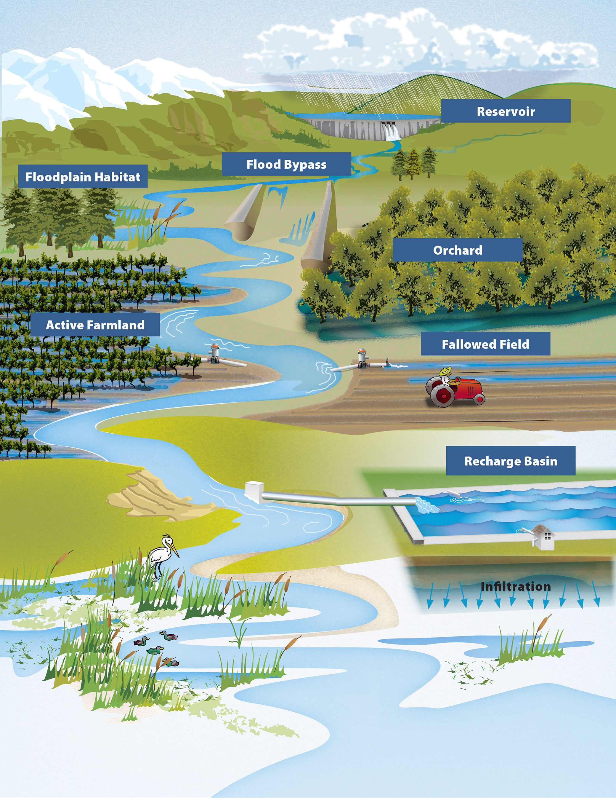
Flood-MAR is a water management strategy that redirects floodwater fromrainfall or snowmeltto agricultural lands, working landscapes, or managed natural lands including refuges, floodplains, and flood bypasses for groundwater recharge. Flood-MAR strategies can be implemented on a small-scale by individual landowners who divert floodwaterusing existing infrastructure or on a larger-scale through extensive detention/recharge areas and modernizing flood management infrastructure/operations.
Flood-MAR projects can provide broad benefits for Californians and the ecosystems of the state, including the following:water supply reliability, flood risk reduction,drought preparedness, aquifer replenishment, ecosystem enhancement, subsidence mitigation, water quality improvement, working landscapepreservation andstewardship,climate change adaptation, andrecreation and aesthetics.
As interest in Flood-MAR projects grows across the state, DWR is working with state, federal, Tribal, and local entities; academia; and landowners to build on existing knowledge, expand implementation, and strengthen Flood-MAR’s role in the state’s long-term water strategy.
Find answers to frequently asked questions about Flood-MAR in the FAQs.
DWR’s Watershed Studies explore two Flood-MAR strategies and examine how changing flood patterns, water supply, and ecosystem health can be jointly managed through coordinated recharge and reservoir operations. The Watershed Studies were conducted to see how they could help water managers reduce climate change risks and build resilience for communities, farms, and the environment.
Merced River Watershed Flood-MAR Reconnaissance Study
To better understand climate vulnerabilities and how to address them, the California Department of Water Resources (DWR) conducted a three-year Merced study in partnership with Merced Irrigation District (MID) as a proof of concept to explore the effectiveness of Flood-MAR to concurrently reduce flood risk, improve water supply, and enhance ecosystems in the Merced River watershed, a tributary to the San Joaquin River. The Merced study is an exploratory watershed-scale analysis to develop and test analytical methods and models, assess climate change vulnerability, and evaluate adaptation strategies meeting multiple benefits that achieve these shared objectives:
- Assess watershed vulnerability to climate change for flood protection, water supply, and ecosystems.
- Develop Flood-MAR strategies reflecting a range of operational complexity and infrastructure improvements.
- Quantitatively evaluate the performance of Flood-MAR strategies in providing multi-sector benefits and climate resilience.
Following is the Merced River Watershed Flood-MAR Reconnaissance Study Report and supporting technical information records (TIR) that explain the development as well as the results of the study:
- Merced River Watershed Flood-MAR Reconnaissance Study Report
- TIR 1 Plan of Study
- TIR 2 Model Integration
- TIR 3 Climate Change Vulnerability Assessment and Baseline Assumptions
- TIR 4 Adaptation Strategy Performance
 TheFlood-MAR Research and Data Development Plan (R&DD Plan) was created by a team of subject matter experts across 13 research themes who identified the research, data, guidance, and tools necessary to support and expand the implementation Flood-MAR projects. There has been a lot of progress since the plan was developed, and an evaluation outlines the advances made on its 39 key actions while also pointing to dozens of resources created to support broader use of Flood-MAR.
Theme-specific Actions and Documentation are available by request to FloodMAR@water.ca.gov.
Coordinating Flood and Groundwater Management Brochure
Learn more about how Flood-MAR can reduce flood risk, boost groundwater recharge, and support climate adaptation by strengthening coordination between flood and groundwater management.
Explore how large-scale Flood-MAR implementation can help rehabilitate and modernize California’s water and flood infrastructure.
The following websites provide additional information and resources on the benefits and issues of using flood waters to recharge groundwater basins.
Contact Us
Events
Blogs

.JPG?mw=200&hash=850470BFF44FBF6B7E4C9B8E00CFA30F)
California’s changing climate brings new challenges each year for water managers as they navigate extreme shifts from drought to flood while working to ensure safe, reliable water supplies for California’s 39 million residents.
Published:
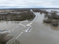
Set into the banks of the Sacramento River as it winds its way south from its Mount Shasta headwaters are six large concrete structures which, despite their size, go largely unnoticed until the rains come and the river rises, threatening floods.
Published:
As climate extremes continue to challenge water management, the California Department of Water Resources (DWR) is working with partners across the state to implement floodplain restoration projects that provide flood protection to communities and benefits for endangered species and natural habitat.
Published:

DWR is using a unique piece of State Water Project SWP infrastructure for the first time since 2006 to reduce the amount of flood waters going into Tulare Lake in the Central Valley.
Published:

The Department of Water Resources (DWR) is maintaining releases from Lake Oroville to the Feather River at 15,000 cubic feet per second (cfs). Due to maintenance work on a buoy line near the Thermalito Afterbay River Outlet, flows through the low-flow channel in the City of Oroville were temporarily increased today to a peak of 9,000 cfs.
Published:

DWR continues to reduce releases from Lake Oroville to the Feather River. Water outflows from the lake were reduced to 15,000 cubic feet per second (cfs) today, with 4,000 cfs flowing through the low-flow channel within the City of Oroville.
Published:

DWR continues to reduce releases from Lake Oroville to the Feather River. Water outflows from the lake were reduced to 20,000 cubic feet per second (cfs) today, with 9,000 cfs flowing through the low-flow channel within the City of Oroville.
Published: