
California has experienced record-breaking wildfires in 2020 with more than 4 million acres burned, increasing the risk of flash flooding along with mud and debris flows to communities and homes downslope of burn areas.
Published:
California has experienced record-breaking wildfires in 2020 with more than 4 million acres burned, increasing the risk of flash flooding along with mud and debris flows to communities and homes downslope of burn areas.
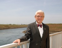
Justice Ronald B. Robie, who served as DWR's fifth director, was honored with a Lifetime Achievement Award from the California Lawyers Association’s Environmental Law Section for his 60 years of contributions to the environmental law field.
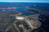
Lake Oroville Community Update for October 16, 2020.

Do you wish you could find hands-on, paid work experience while in school? DWR's Student Assistant Program offers on-the-job training to individuals enrolled in high school, college, or any recognized school of learning.
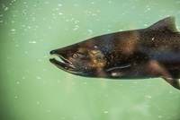
A team of DWR scientists are working with federal and state partners to embrace the challenge of overseeing the implementation of one of the most complex endangered species permits in California history.
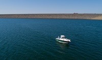
Lake Oroville Community Update for October 9, 2020.
California’s 2020 legislative session came to an end Sept. 30 with several new bills signed into law that will impact water operations and the Department of Water Resources.
Lake Oroville Community Update for October 2, 2020.

Healthy communities need clean, reliable water supplies. That is why your thoughts, and ideas need to be shared with local water agencies as they create plans that map out how groundwater will be managed for the next 50 years.
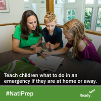
Preparing for a flood disaster starts at home. Disasters can happen everywhere, and every member of the family should be part of the planning, including young children and teens.