Lake Oroville Community Update - May 28, 2021
Boaters on Lake Oroville. DWR/2019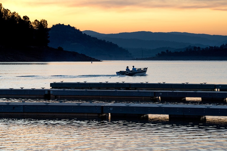
Oroville Recreation
Visitors to Lake Oroville for the Memorial Day holiday will find the Lime Saddle, Bidwell Canyon Stage III, Spillway, and the newly opened Loafer Point Stage II boat ramps open for use. Although currently at just under half of the historical water storage average for this time of year, Lake Oroville still provides nearly 7,000 acres of water surface for fishing, water sports, and recreation.
More than 97 miles of trails and numerous Day Use Area (DUA) facilities with picnic tables and restrooms at Lake Oroville State Recreation Area (LOSRA) are open 8 a.m. to sunset. Bidwell, Lime Saddle, and Loafer Creek recreation areas are open 24 hours. Summer access hours of 5 a.m. to 11 p.m. daily is now in effect for the Spillway Boat Ramp Area - gates close at 11 p.m. Vehicle access to Oroville Dam Crest Road across Oroville Dam is available 5 a.m. to 11 p.m. daily.
Exercise enthusiasts can log a round-trip of just over two miles while they enjoy the spectacular views from Oroville Dam Crest Road across the top of the dam, which is open to walkers, joggers, and bicyclists 24-hours a day. Visitors can also go to the Thermalito North Forebay’s Forebay Aquatic Center to rent kayaks and paddle boards. Sandy beaches are available at North Forebay and the Thermalito Afterbay’s Monument Hill.
Reservations for LOSRA campgrounds are available on the California Department of Parks and Recreation (CA Parks) website, including reservations for the Lake’s floating campgrounds. Lime Saddle group camping remains closed. The Lake Oroville Visitor Center remains closed due to COVID-19 restrictions.
Visit the California Parks LOSRA webpage for current information on facility status, campground reservations, and to find current requirements to protect public health during the COVID-19 pandemic. Information can also be found on the Lake Oroville Recreation webpage and the California Department of Fish and Wildlife webpage.
Oroville Dam Citizens Advisory Commission Public Meeting
The California Natural Resources Agency held its seventh Oroville Dam Citizens Advisory Commission (OCAC) meeting on Friday, May 28. The online public meeting included an update on dam safety and presentations on risk assessment. Members of the public also asked questions and gained information on these and other topics. The Citizens Advisory Commission is a forum for the community to provide feedback and ask questions. The meeting transcript and presentations will be available on the Commission’s website in the coming weeks.
CAL FIRE Controlled Burn Planned at Thermalito Forebay
In cooperation with the Department of Water Resources (DWR) and CA Parks, CAL FIRE/Butte County Fire Department plans to conduct a series of vegetation management (VMP) burns around the Thermalito Forebay during the first week of June, dependent on forecast weather conditions and fire personnel activity. The burns will be in areas near the Forebay Aquatic Center, Nelson Sports Complex, South Forebay near Grand Avenue, and near Wilbur Road and Tres Vias Road.
The VMP controlled burns have multiple beneficial impacts for the natural environment and public safety. The targeted grasslands are home to many vernal pools that support a high diversity of plants and animals, including rare and endangered species and species endemic to California (i.e., found nowhere else in the world).
Fire from carefully controlled burns is the most powerful tool to combat invasive plants and their seeds such as dry invasive grass buildup called ‘thatch’ and invasive plants such as star thistle. Removal of invasive species allows native plants and animal species, such as fairy shrimp, to thrive. The burns will also remove dangerous fire fuels from grassland adjacent to private property and near high-use areas. Up to 250 acres are targeted for burning.
More Than 65 Acres Treated Around Lake Oroville This Season
Fuel reduction work around Oroville continues to improve forest health and reduce fire risk. In partnership with Butte County Fire Safe Council, Butte County Sheriff’s Office (BCSO), the California Conservation Corps (CCC), CA State Parks, and CAL FIRE, DWR’s Fuel Load Management Plan (FLMP) work has thinned approximately 25 acres of overgrown vegetation and trees, as well as cut, piled, and chipped approximately 40 acres of dead and dying hazardous fuels (trees and vegetation) from the North Complex wildfire burn scar at Loafer Creek.
CAL FIRE and CCC crews are continuing to work within the North Complex wildfire burn scar using heavy equipment and hand crews to cut, pile, and chip burnt vegetation and trees. The piles will be burned this fall when conditions are safe for burning. BCSO crews are continuing to chip cut vegetation near the Equestrian Camp at Loafer Creek. Green Mountain Contractors, Inc. just completed a 13-acre thinning and chipping project along Highway 162 and the entrance to Loafer Creek Recreation area. FLMP efforts will be winding down as hotter and drier conditions elevate risk of accidental ignitions.
Blue Green Algae Monitoring
DWR environmental scientists regularly monitor for blue-green algae and their toxins during the summer months. There are currently no HAB advisories for Lake Oroville, Upper Feather River lakes, the Thermalito Forebay, or the Thermalito Afterbay. Water samples are taken at various locations regularly from Memorial Day through Labor Day and sent to a lab for toxin analysis.
Blue-green algae (cyanobacteria) is a natural component of ecosystems. Under certain conditions, including warmer temperatures and increased nutrient loads, algae can grow rapidly causing “blooms.” Algal blooms sometimes produce toxins that can be harmful to people and animals. Algal blooms can make the water appear green, blue, or brown in color. Seeing colors, mats, foam, scum, or paint-like streaks in the water may indicate a bloom is present. Keep animals and children away from the water when a suspected harmful algal bloom (HAB) is present and report the possible HAB immediately.
If elevated levels of cyanobacteria toxins are found while testing, DWR staff will work with California’s Regional Water Quality Control Board and recreation area managers to notify the public and post advisory signs at affected waterbodies. To learn more about HABs, or to report a HAB visit the Water Board’s website.
Current Lake Operations
The elevation of Oroville’s reservoir is about 713 feet elevation and storage is about 1.36 million acre-feet -- 39 percent full and 46 percent of historical average. Currently, in the Northern Sierra Basin, rainfall is below average, at 47 percent of normal for this time of year and snowpack is also below average at four percent of normal. An excessive heat watch is in effect from Sunday afternoon through Tuesday evening with temperatures well above 100 degrees. Expect temperatures to remain in the upper 90s low 100s through the remainder of the week.
Currently, flows down the low flow channel through the City of Oroville are at 650 cfs and 1,250 cfs is being released from the Thermalito Afterbay Outlet (Outlet) for a total of 1,850 cfs downstream of the Outlet. Current releases are for meeting downstream water quality and flow requirements and are re-assessed on a daily basis. Flows may fluctuate through the low flow channel for fisheries purposes during the week.
The public can track precipitation, snow, reservoir levels, and more at the California Data Exchange Center at www.cdec.water.ca.gov. Lake Oroville is identified as “ORO”.
All data as of midnight 5/27/2021