Update on Lake Oroville Operations (Alert) - March 16, 2023
Water flows from the Lake Oroville main spillway on March 10, 2023.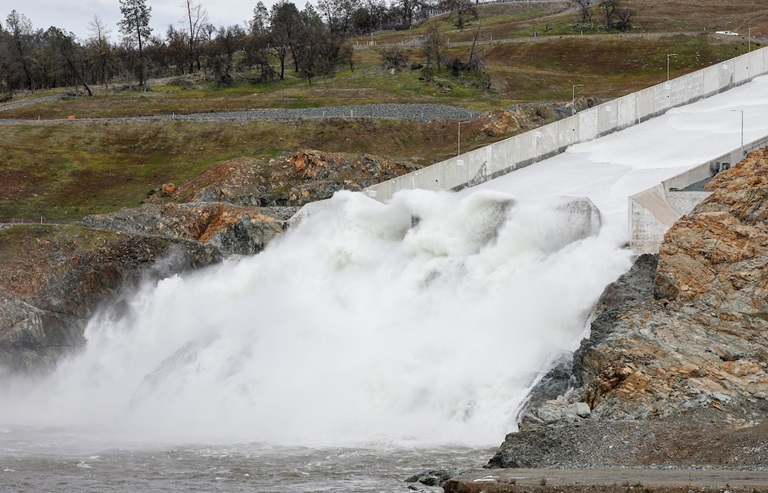
The Department of Water Resources (DWR) is alerting Butte County and Oroville residents of the impending closure of Oro Dam Blvd. E. between Rusty Dusty Road and Canyon Drive due to increased releases from the main spillway at Oroville Dam. Beginning at 9 a.m. on Friday, March 17, Oro Dam Blvd. E. will be closed to traffic prior to increasing spillway releases in stages from 25,000 cubic feet per second (cfs) to 35,000 cfs.
When releases from the main spillway exceed 30,000 cfs, water spray can reduce driver visibility on the roadway, requiring a closure for public safety. Motorists may still access Oroville Dam and the State Recreation Area via State Route 162 (Oro Quincy Highway) and Canyon Drive. Oro Dam Blvd. E. will remain closed to traffic until releases from the main spillway are reduced.
In addition, flows through the low-flow channel within the City of Oroville will begin increasing starting at 10 a.m. Friday. Flows in the low-flow channel will increase gradually from 13,000 cfs to 23,000 cfs by 4 p.m. Releases from Lake Oroville are being made in coordination with the U.S. Army Corps of Engineers and downstream water operators for flood control protection to downstream communities. DWR continues to closely monitor lake inflow levels and will adjust releases accordingly.
The information below reflects current reservoir level estimates. Forecasts can change quickly and may affect the estimates provided.
- Current Oroville Reservoir Level: 858 feet elevation
- Total Releases to the Feather River: 25,000 cfs; will increase to 35,000 cfs on Friday
The Lake Oroville reservoir is the largest storage facility in the State Water Project and supports environmental and water delivery needs to 27 million Californians and reduces flood risks to downstream communities. DWR continues to monitor lake levels, weather forecasts, and mountain snow levels to optimize operations for flood control, water storage and environmental protection while allowing for carryover storage into next year.