Lake Oroville Community Update - February 10, 2023
Image of Lake Oroville on Jan. 10, 2023.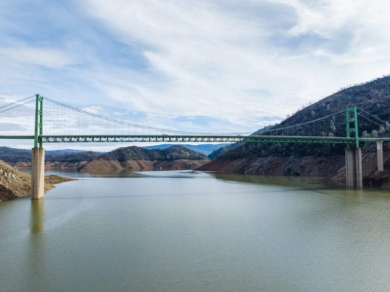
Oroville Dam Citizens Advisory Commission
The California Natural Resources Agency is hosting its 13th Oroville Dam Citizens Advisory Commission meeting on Feb. 24, 10 a.m. to noon. The public meeting will be held at the Southside Oroville Community Center located at 2959 Lower Wyandotte Road, Oroville, CA 95966, and will include presentations and public comment. The Commission will receive a briefing on the January storm events and a presentation on reservoir debris maintenance and spillway capacity. The Citizens Advisory Commission is a forum for questions and feedback from the communities surrounding Oroville Dam.
Driftwood at Lake Oroville
The California Department of Parks and Recreation (DPR), Department of Water Resources (DWR) and marina partners at Lake Oroville State Recreation Area advise recreational boaters to navigate carefully in areas where driftwood is present.
Driftwood and other floating debris at the state recreation area are expected due to high water inflows from tributaries and rising lake levels, in combination with past wildfires impacting the watershed. This month State officials and marina partners have been working daily on collecting, containing, and pulling pieces of wood out of the lake and away from boat launch ramps using boom lines.
In past years, vandals have occasionally cut log booms, resulting in large amounts of debris released in the lake and around boat launch ramps. To alleviate the impact of driftwood on the state recreation area, DPR is asking the public to report any cutting or tampering of boom lines and any driftwood vessel accidents by calling the Lake Oroville State Recreation Area Dispatch Center at (916) 358-1300.
Due to an excess of driftwood, members of the public are no longer limited to collecting 50 pounds of driftwood per day. Any remaining driftwood will be disposed of within the recreation area to help reduce impacts next year.
For information on the state recreation area, please visit www.parks.ca.gov/LakeOroville.
Rising Reservoir Levels
Thanks to the January storms, Lake Oroville reservoir levels have risen more than 150 feet since Dec. 1. The reservoir level, now at 817 feet, has reached the gates of the spillway. The public may see water on the main spillway outlet, which is expected as the gates are not designed to be watertight. DWR continues to manage Lake Oroville to collect as much runoff as possible while also providing flood control benefits for downstream communities, important examples of the multiple purposes of DWR’s Oroville Facilities. These actions are coordinated with a variety of other agencies and are subject to state and federal regulations.
Fuel Load Management
DWR continues vegetation management and debris cleanup activities around the Feather River Fish Hatchery to remove overgrown ladder fuels and create a more wildfire resilient landscape. In addition, CAL FIRE, Butte County Fire Department, and the California Conservation Corps (CCC) Butte Fire Center continue cutting and pile burning activities in the Loafer Creek area and along Oro Dam Boulevard East near the Hyatt Powerplant.
Over the next couple weeks, the Butte County Sheriff crew will be cutting and piling material along Canyon Drive to reduce overgrown vegetation near the community of Kelly Ridge. CAL FIRE will burn the brush piles at a later date.
DWR is implementing a Fuel Load Management Plan (FLMP) at its Oroville Facilities to reduce wildfire risk and increase public safety around Lake Oroville and surrounding communities. Vegetation management activities will continue through the spring, weather permitting. Smoke from pile burning activities will continue to be visible in the Oroville area.
Oroville Recreation
The Lake Oroville Visitor Center has expanded hours and is now open to the public Monday through Friday between 9 a.m. and 5 p.m. The Visitor Center features interpretive displays on Oroville Dam, area geology, wildlife and habitat, hydroelectric power, and cultural and historical artifacts. View videos in the theater about the construction of Oroville Dam, walk or hike along nearby trails, and visit the 47-foot-tall observation tower that provides unsurpassed panoramic views of surrounding areas. Free guided tours for school and community groups are available by reservation.
Lake Oroville is one of the State Water Project’s premier recreational destinations and one of California’s best fishing spots. The lake provides both warm-water and cold-water fisheries. Below the Oroville Dam, the Thermalito Forebay, Thermalito Afterbay and the Feather River offer additional excellent fishing opportunities for Chinook salmon and steelhead.
Paved boat ramps are available at the Spillway, Loafer Point, Loafer Creek, Bidwell Canyon, Lime Saddle, the Thermalito Afterbay, and the Thermalito Forebay. The marinas at Bidwell Canyon and Lime Saddle are open daily and provide a variety of services such as a shuttle and boat rentals.
DWR, State Parks, and California Department of Fish & Wildlife maintain over 92 miles of trails in the Oroville area. An interactive map of recreation facilities and their permitted uses (hike, bike, horse, multi) is available on DWR’s Lake Oroville Recreation webpage.
Current Lake Operations
Oroville’s reservoir is about 817 feet elevation and storage is approximately 2.4 million acre-feet (MAF), which is 68 percent of its total capacity and 114 percent of the historical average. The weather forecast for the coming week remains mostly dry with showers possible next weekend.
The Feather River releases are currently at 950 cubic feet per second (cfs). Flows through the City of Oroville are 650 cfs with 300 cfs released from the Thermalito Afterbay Outlet (Outlet) for a total of 950 cfs downstream of the Outlet. DWR continues to assess releases to the Feather River daily.
The public can track precipitation, snow, reservoir levels, and more at the California Data Exchange Center. The Lake Oroville gage station is identified as “ORO”.
All data as of midnight 2/9/2023.