Lake Oroville Community Update - March 18, 2022
Boaters on Lake Oroville on Jan. 25, 2022.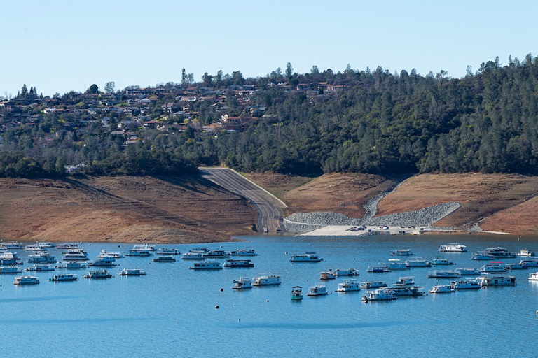
DWR Begins Monitoring Vernal Pools
Some grasslands, including areas around Butte County, have an underlying impervious layer of rock or clay that causes rainwater to pond in the winter and spring, creating seasonal wetlands called vernal pools. Although vernal pools are only a small component of our local grasslands in terms of area, they support a remarkably high diversity of plants and animals, including rare and endangered species and species endemic to California (i.e., found nowhere else in the world).
Vernal pool organisms and plants are highly specialized to their unique environment and to the Mediterranean-type climate found in California. They have adapted to living in pools that fill in the winter but are completely dry by the summer, as well as adapting to the sometimes-extreme variability in temperature and rainfall between years. Vernal pools are important targets for conservation because most vernal pools in California have been lost to development, agriculture, and habitat degradation from invasive plants.
Vernal pools often support spectacular wildflowers that bloom from March to May. Each spring, Department of Water Resources (DWR) environmental scientists from the Oroville Field Division monitor hundreds of vernal pools around the Oroville area and make assessments on how protection measures for these valuable environmental resources are succeeding.
This year scientists are observing wildflowers blooming earlier, likely due to drought conditions, which has reduced the number of “wet” vernal pools found. Scientists also noticed that the areas where CAL FIRE performed controlled burns around the Thermalito Forebay last year to remove invasive grass buildup, or ‘thatch’, and other invasive plants, are abundant with flowers – demonstrating the benefit of such activity on area grasslands and vernal pools.
Oroville Dam Citizens Advisory Commission
The California Natural Resources Agency is hosting its tenth Oroville Dam Citizens Advisory Commission meeting on Friday, March 25, 2022, from 10 a.m. to 12 p.m. The public meeting will be held online and will include presentations and public comment. The Commission will receive brief facilities updates from DWR, receive a flood risk presentation, discuss public safety partnerships, and listen to public input.
The Citizens Advisory Commission is a forum to provide public feedback from the communities surrounding Oroville Dam. For information on how to join the virtual meeting, visit https://bit.ly/OrovilleCAC.
Oroville Recreation
The Loafer Point, Bidwell Canyon, and Lime Saddle boat ramps are open. The Oroville Dam Spillway boat ramp remains closed for repairs. The Foreman Creek and Stringtown cartop boat ramps are also open.
Intermittent, short duration closures of the Oroville Dam Crest parking lot may occur to accommodate Lakeside Access Road construction activities. The popular walking/bicycling trail across the top of the dam will remain open and parking will continue to be available at the Upper Overlook.
Information on current boat ramp status can be found on the California State Parks’ Lake Oroville State Recreation Area webpage. Scroll down to the link for “Current Launch Ramp Status”.
The Lake Oroville Visitor Center is open to the public on Tuesdays, Wednesdays, and Thursdays from 9 a.m. to 5 p.m. Pick up the Lake Oroville Trails Map, which shows more than 91 miles of trails available to equestrians, bicyclists, and hikers, at Lake Oroville State Recreation Area (LOSRA) kiosks, the Oroville Area Chamber of Commerce, or the Feather River Recreation and Parks District. The Loafer Creek Recreation Area continues to be closed due to waterline repair (boat ramp access allowed).
Visit the California Parks LOSRA webpage for current information on facility status and campground reservations. An interactive map of recreation facilities in DWR’s Oroville-Thermalito Complex is available on DWR’s Lake Oroville Recreation webpage. Information about the 11,000-acre Oroville Wildlife Area is available on the California Department of Fish and Wildlife webpage.
Current Lake Operations
The elevation of Oroville’s reservoir is about 743 feet elevation and storage is about 1.61 million acre-feet, which is 46 percent of its total capacity and 68 percent of historical average. Temperatures over the weekend are forecasted to be cooler in the low-60s and about a 0.5 inch of rain in the Feather River Basin is expected. Dry and warmer temperatures in the mid- to-upper-80s are projected to occur next week.
The average daily inflows this week have been around 3,000 to 4,000 cubic feet per second (cfs) and are projected to continue at this rate next week. Inflows are subject to change based upon on actual weather conditions.
Total flows to the Feather River are 2,500 cfs. Flow in the low-flow channel through the City of Oroville is 650 cfs and flow through the Thermalito Afterbay Outlet currently is 1,850 cfs. Flows are assessed daily.
The public can track precipitation, snow, reservoir levels, and more at the California Data Exchange Center at www.cdec.water.ca.gov. The Lake Oroville gage station is identified as “ORO”.
All data as of midnight 3/17/2022
California is entering its third year of drought conditions. With water conservation now a way of life in California, everyone is encouraged to find ways to save water. See tips, tools, and ideas on the Save Our Water website. Information about real time local hydrological conditions, forecasts, and water conditions is available on DWR’s new website California Water Watch. Visit DWR’s Drought webpage for the latest information.