Lake Oroville Community Update - February 18, 2022
Boaters on Lake Oroville on Jan. 25, 2022.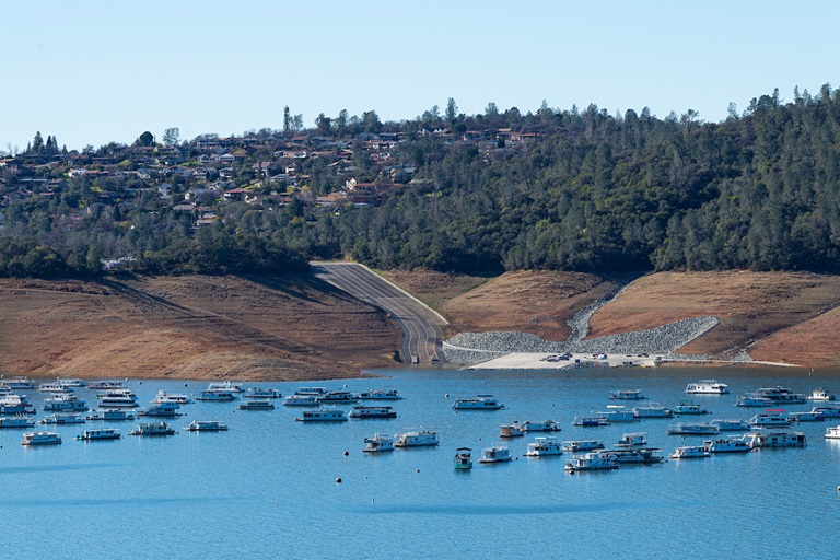
DWR Launches California Water Watch
The Department of Water Resources (DWR) has a new website to better inform Californians about hydrologic conditions, forecasts, and information at the scale of their local watershed. The website, California Water Watch -- allows the public to obtain a quick snapshot of local and statewide water conditions and was developed as part of the Governor’s drought emergency proclamation. Information is updated from a variety of data sources and will assist the public to research, learn, and stay informed about California’s most precious resource – water.
The website displays current statewide hydroclimate and water supply conditions, including precipitation, temperature, reservoir storage, groundwater conditions, snowpack, streamflow, soil moisture and vegetation conditions. Links to information about drought conditions and how water is used in California are also provided.
Oroville Recreation
The Loafer Point, Bidwell Canyon, and Lime Saddle boat ramps are open. The Oroville Dam Spillway boat ramp remains closed for repairs. The Foreman Creek and Stringtown cartop boat ramps are also open. Information on current boat ramp status can be found on the California State Parks’ Lake Oroville State Recreation Area webpage. Scroll down to the link for “Current Boat Launch Status”.
The Lake Oroville Visitor Center is open to the public on Tuesdays, Wednesdays, and Thursdays from 9 a.m. to 5 p.m. Pick up the Lake Oroville Trails Map, which shows more than 97 miles of trails available to equestrians, bicyclists, and hikers, at Lake Oroville State Recreation Area (LOSRA) kiosks, the Oroville Area Chamber of Commerce, or the Feather River Recreation and Parks District. The Loafer Creek Recreation Area continues to be closed due to waterline repair (boat ramp access allowed).
Visit the California Parks LOSRA webpage for current information on facility status and campground reservations. An interactive map of recreation facilities in DWR’s Oroville-Thermalito Complex is available on DWR’s Lake Oroville Recreation webpage. Information about the 11,000-acre Oroville Wildlife Area is available on the California Department of Fish and Wildlife webpage.
Lakeside Access Road
Construction activities associated with the Lakeside Access Road project continue to result in intermittent closures of the Oroville Dam Crest parking lot on the northwest side of the dam as well as the Spillway Boat Ramp area. These short duration closures are anticipated to continue until the end of February. The popular walking/bicycling trail across the top of the dam will remain open and parking will continue to be available at the Upper Overlook.
This project will consist of a new, permanent, paved road from the west side of Oroville Dam to the Spillway Boat Ramp parking lot on the “lakeside,” or waterside, of the Oroville Dam spillways. This new road will allow a more direct route when water levels are low in Lake Oroville. The new road will include two concrete traffic lanes, wide shoulders for walking and biking, guardrails, and safety signage.
Current Lake Operations
The elevation of Oroville’s reservoir is about 747 feet elevation and storage is about 1.65 million acre-feet, which is 47 percent of its total capacity and 77 percent of historical average. Temperatures over the weekend are forecasted to be in the high 60s to low 40s. Next week’s temperatures are forecasted to decrease to low-60s in the daytime and low- to upper-30s at night.
The average daily inflows this week have been in the range of 4,000 cubic feet per second (cfs) to 5,000 cfs. Inflows through the weekend and next week are forecasted to be around 3,500 cfs to 4,500 cfs. Inflows are subject to change based upon on actual weather conditions.
Total flows to the Feather River are 3,500 cfs. This increase is for downstream water quality and flow requirements. Flow in the low-flow channel through the City of Oroville is 650 cfs and flow through the Thermalito Afterbay Outlet is 2,850 cfs. Releases are assessed daily.
The public can track precipitation, snow, reservoir levels, and more at the California Data Exchange Center at www.cdec.water.ca.gov. The Lake Oroville gage station is identified as “ORO”.
All data as of midnight 2/17/2022