Monitoring Stations in the Feather River Watershed Inform Statewide Water Supply
Sensors at a monitoring station in the Feather River watershed. DWR/2021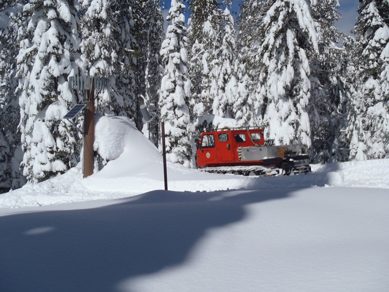
Every year, the Department of Water Resources (DWR) relies on data from monitoring stations strategically located across California to provide information that will aid the decision-making process regarding the flood control and water supply operations of California’s State Water Project (SWP).
The Feather River watershed, located in Northern California’s Sierra Nevada mountains south of Mt. Lassen, is a key location for collecting data. It is the largest watershed in the Sierra Nevada, covering 2.3 million acres or 3,200 square miles.
The water within the watershed drains into Lake Oroville, the reservoir behind Oroville Dam. Capable of holding about 3.5 million-acre-feet of water, Lake Oroville is the largest water storage facility for the SWP, which provides water to 27 million Californians and irrigation to over 750,000 acres of farmland.
Monitoring station network collects critical information
Hydrologists at DWR and other agencies such as the National Weather Service, U.S. Forest Service, PG&E, and local counties and municipalities, have built a network of more than 100 monitoring stations in the watershed to forecast how much water will flow into Lake Oroville at any given time.
Monitoring stations collect a wide variety of information, including precipitation -- which can fall as rain, sleet, or snow -- stream flow, soil moisture, temperature, solar radiation, or wind speed and direction.
“The value of our Statewide Hydrometeorological Monitoring network cannot be overstated,” said David Rizzardo who oversees DWR’s Hydrology Branch. “The network of over 1,000 monitoring stations across California allows DWR and our partner agencies to closely monitor conditions in the watersheds, providing us with critical data to manage our natural resources and respond effectively to natural disasters like floods, droughts, or wildfire.”
Inflow forecasts inform water operations
A critical data point collected at many of the stations is soil moisture. For example, agencies like the U.S. Forest Service use soil moisture data to monitor fire risk conditions or check on forest health. Hydrologists from DWR and the National Weather Service’s California-Nevada River Forecasting Center use soil moisture data from the Feather River watershed to develop inflow forecasts for Lake Oroville.
Soil moisture measurements are important because dry soil more readily absorbs water, but soil already saturated by continuous wet conditions will shed the water, creating increased inflows into reservoirs, rivers and lakes.
Inflow forecasts also provide real-time information to water managers, who then inform the operators of Oroville Dam to adjust releases from the reservoir to maximize water storage or water deliveries, while providing increased flood protection to downstream communities.
Measuring snowpack’s water content
For water managers, the most important characteristic of snow is its water content. An instrument called a ”snow sensor” collects data about snow water content, a predictor for the expected volume of snowmelt that fills California’s reservoirs during dry summer and fall months.
There are 10 DWR-operated snow sensor monitoring stations in the Feather River watershed. The sensor is a four-feet square or larger device that senses the pressure, or weight, of the snow accumulated on top of it. In addition, DWR staff travels monthly to the Feather River watershed’s remote snow course locations from December to May to perform manual survey measurements.
The manual snow survey measurements and snow sensor data from across the Sierra provide direct measurement of the snow’s water content, or snow water equivalent (SWE), used by hydrologists in runoff forecast models to estimate the amount of melted snow that will flow into the SWP and major California reservoirs like Lake Oroville.
“In critically dry or wet years, all the observations that are made during the snow surveys are especially important to forecasters,” said Clint Womack, water services supervisor with DWR’s Oroville Field Division. “Observations often include whether the creeks are frozen or running, if the water in the creek is clear or muddy, or if the ground under the snow is dry or wet. Additionally, our manual measurements help determine if the sensors are accurately reporting data.”
Results from all the snow course measurements can be found on the snow course report on the CDEC website.
As climate change increases the frequency of changes between wet and dry years, California’s water managers and water consumers can rely on the extensive network of water monitoring stations across California to provide accurate and reliable data needed to guide the state’s water supply and flood management decisions.