Lake Oroville Community Update - December 3, 2021
Aerial view of Lake Oroville on Oct. 28, 2021.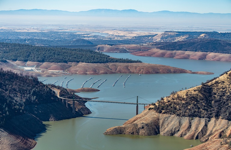
Oroville Dam Citizens Advisory Commission Public Meeting
The California Natural Resources Agency (CNRA) held its ninth Oroville Dam Citizens Advisory Commission meeting on Dec. 3, 2021. The online public meeting included presentations about downstream flood management and preparedness as well as an update on the Water Control Manual from a representative of the U.S. Army Corps of Engineers. Members of the public also offered comments and asked questions. The Citizens Advisory Commission is a forum to provide public feedback from the communities surrounding Oroville Dam. The meeting transcript and presentations will be available on the Commission’s website in the coming weeks at https://bit.ly/OrovilleCAC.
New Invasive Plants Discovered
Environmental scientists with the Department of Water Resources (DWR) Oroville Field Division have discovered a new aquatic invasive plant in the Feather River downstream of Oroville. The new floating aquatic plant is the South American spongeplant (Limnobium spongia), previously known from the Sacramento River and the Sacramento-San Joaquin Delta. This is the second new, high-rated (by the California Invasive Plant Council) invasive plant species DWR has discovered in the Feather River in the last three years. In 2019, alligator weed (Alternanthera philoxeroides) was found adjacent to the Feather River Outlet Boat Ramp. Neither of these species were previously known in Butte County but have been expanding in recent years across California.
Aquatic invasive species (AIS) move from one area to another via watercraft, personal water gear, pets who have entered the water, and by wildlife. You can help minimize the spread of AIS by thoroughly inspecting all equipment after leaving a waterbody; clean any visible mud and plants from watercrafts, equipment, and personal gear; and drain water from all equipment, including bait buckets, and ballast tanks. Cleaning and drying anything that came in contact with water (including pets and clothing) will help prevent the spread of AIS.
Invasive plants can de-stabilize dissolved oxygen cycles needed by fish and aquatic organisms, crowd out native plants, shade out crucial shallow-water fish habitat, obstruct waterways and navigational channels, and block agricultural and municipal water intakes.
Loafer Creek Fuels Management
With the firefighting season wrapping up, crews from CAL FIRE’s Butte Fire Center, along with crews from California Conservation Corps and Butte County Sheriff Office, are performing various fuel reduction projects using heavy equipment, hand cutting, chipping, and burning of prioritized overgrown vegetative areas within the Federal Energy Regulatory Commission (FERC) project boundary of DWR’s Oroville-Thermalito Complex.
Hikers and equestrian users of the Roy Rogers Trail in the Loafer Creek Recreation Area, visitors to the area, and motorists along Highway 162 are advised to be mindful of safety when near work zones.
Oroville Recreation
Bidwell Canyon’s Stage III concrete boat ramp and the single-lane gravel boat ramp at Oroville Dam’s Spillway Boat Ramp area are open. The Spillway ramp will continue to be open as conditions permit. Boaters on the lake are advised to be aware of unexpected shallow water, obstruction hazards, and floating debris.
The Lime Saddle Marina is now open for customer access, but with very limited services due to damage caused by the October storm event. At this time, the boat ramp remains out of the water. Access to boats and houseboats at both Bidwell Canyon and Lime Saddle marinas should be coordinated through the marina prior to arrival by calling (530) 589-9175 or by utilizing the shuttle service at Bidwell Canyon Marina.
The Lake Oroville Visitor Center is open to the public on Tuesdays, Wednesdays, and Thursdays from 9 a.m. to 5 p.m. Visitors can tour the center’s educational exhibits and area grounds with trails and climb the 47-foot-tall viewing tower with great views of Lake Oroville, the Sierra, the valley, and Sutter Buttes. Please contact the VC Guides at (530) 538-2219 for more information.
Numerous Day Use Area (DUA) facilities with picnic tables and restrooms at Lake Oroville State Recreation Area (LOSRA) are open 8 a.m. to sunset. Bidwell, Lime Saddle, and Loafer Creek recreation areas are open 24 hours. The Oroville Dam Crest Road across Oroville Dam is available 5 a.m. to 11 p.m. daily with the spillway trailhead and boat launch open from 6 a.m. to 8 p.m. The top of the dam is open to pedestrians and bicyclists 24-hours a day.
A new trails map showing the over 97 miles of trails available to equestrians, bicyclists, and hikers is available at LOSRA kiosks, Oroville Wildlife Area office on Oro Dam Boulevard West, the Oroville Area Chamber of Commerce, and Feather River Recreation and Parks District and other area locations.
Links to LOSRA, the Oroville Wildlife Area, and an interactive map of recreation facilities in DWR’s Oroville-Thermalito Complex is available on DWR’s Lake Oroville Recreation webpage at https://water.ca.gov/What-We-Do/Recreation/Lake-Oroville-Recreation.
Current Lake Operations
The elevation of Oroville’s reservoir is about 672 feet elevation and storage is about 1.05 million acre-feet, which is 30 percent of its total capacity and 60 percent of historical average. The current forecast indicates mainly dry conditions through the weekend and into next week with possible rain later in the week. Temperatures will range in the upper 50s- to low-60s this weekend and continuing into next week.
Total flows to the Feather River are at 1,500 cubic feet per second (cfs) for meeting downstream water quality and flow requirements. Flow in the low-flow channel, through the City of Oroville, is 650 cfs and flow through the Thermalito Afterbay Outlet is 850 cfs. Releases are assessed daily.
The public can track precipitation, snow, reservoir levels, and more at the California Data Exchange Center at www.cdec.water.ca.gov. Lake Oroville is identified as “ORO”.
All data as of midnight 12/02/2021