Lake Oroville Community Update - August 6, 2021
Generating units at Hyatt Powerplant go offline due to low lake levels. 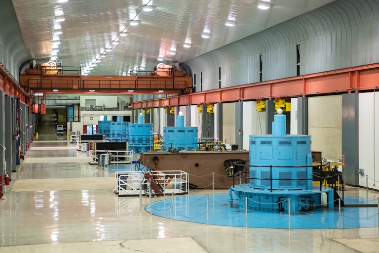
Hyatt Powerplant
On August 5, DWR State Water Project operations managers took the Hyatt Powerplant at Lake Oroville offline due to falling lake levels. This is the first time Hyatt Powerplant has gone offline as a result of low lake levels. However, DWR anticipated this moment, and the state has planned for its loss in both water and grid management.
DWR has been in regular communication about the status of Hyatt Powerplant with the California Independent Service Operator (CAISO) and the California Energy Commission and steps have been taken in anticipation of the loss of power generation.
DWR will continue to focus on reservoir operations and water storage management at Lake Oroville to preserve as much water in storage as possible. DWR will use the River Valve Outlet System to release some water from the base of Oroville Dam to maintain river temperature requirements and outflows to the Feather River.
Lake Oroville Historic Water Levels
Climate change-induced early warm temperatures and extremely dry soils dramatically reduced expected runoff into rivers and reservoirs this spring. Combined with the past two years being the driest two-year period since 1976-1977, water levels at Lake Oroville reached historic lows this past week, falling below the previous low water elevation of 645 feet set in September 1977. Water elevations as low as 620 feet above sea level are forecasted for late October. The Lake Oroville Storage Forecast Chart can be found on the State Water Project Operations and Maintenance website.
Lake Oroville Seaplane Airport
Low water levels have resulted in the California Department of Parks and Recreation (State Parks) decision to close Lake Oroville’s seaplane airport due to an increased presence of tree snags and other hazards surfacing above and just below the waterline. State Parks has notified the Federal Aviation Administration (FAA) that the seaplane airport will be closed until January 31, 2022. The main body of Lake Oroville is a FAA-listed seaplane airport under the management of State Parks.
Lake Oroville Boating Hours
On August 5, State Parks issued an order for the Lake Oroville State Recreation Area (LOSRA) that boating access on Lake Oroville is not permitted starting one-half hour after sunset and ending one-half hour before sunrise due to navigational hazards. Houseboats and vessels remaining on the water must be on their mooring ball or in a slip during hours of lake closure. Additional information can be obtained by calling State Parks at (530) 538-2200.
Boating at Oroville
Lake Oroville’s only remaining boat ramp at the Spillway is not currently permitting the launch of trailered boats due to unsafe conditions, effective Friday, August 6. Hand launching at the gravel, single-lane boat ramp of small boats such as canoes or kayaks is permitted. As lake levels drop, the condition of the ramp will continue to be assessed for future use.
Boaters are reminded that low lake levels bring new boating hazards, including tree stumps and snags, and newly emerging outcrops. Both the Lime Saddle and Bidwell Canyon marinas remain open from 8 a.m. until sundown with shuttle service and boat rentals available.
Power boats are allowed on the Thermalito South Forebay as well as the Thermalito Afterbay. A 5-miles per hour speed limit for all boats is in force on the Afterbay north of the Highway 162 bridge and near the brood ponds on the east side of the reservoir. No motorized boating is allowed in the Thermalito North Forebay.
The Monument Hill facility at Thermalito Afterbay provides boat ramp access, restrooms, a picnic area, and a swim beach. The Thermalito South Forebay facility has a two-lane boat ramp, parking, restroom, picnic tables, BBQs, shade trees, and a fish cleaning station.
Oroville Recreation
Visitors to the Thermalito North Forebay will find a full CA Parks facility with restrooms, picnic areas, a swim beach, and the Forebay Aquatic Center with kayaks, paddle boards, and other watercraft available for rent.
Numerous Day Use Area (DUA) facilities with picnic tables and restrooms at Lake Oroville State Recreation Area (LOSRA) are open 8 a.m. to sunset. Bidwell, Lime Saddle, and Loafer Creek Recreation Areas are open 24 hours. The Oroville Dam Crest Road across Oroville Dam is available 5 a.m. to 11 p.m. daily and open to pedestrians and bicyclists 24-hours a day. The Lake Oroville Visitor Center anticipates re-opening later this summer.
Visit the California Parks LOSRA webpage for current information on facility status and campground reservations. An interactive map of recreation facilities in DWR’s Oroville-Thermalito Complex is available on DWR’s Lake Oroville Recreation webpage. Information about the 11,000-acre Oroville Wildlife Area is available on the California Department of Fish and Wildlife webpage.
Trails Map
A map of the trails maintained by DWR and CA Parks is now available at many Oroville locations including LOSRA kiosks, Oroville Wildlife Area office on Oro Dam Boulevard West, the Oroville Area Chamber of Commerce, and Feather River Recreation and Parks District.
The map, which folds to pocket size, provides information on permitted trail uses, elevation changes, trail length, and locations of more than 97 miles of trails around Lake Oroville, along the Feather River, Thermalito Forebays and Afterbay, and the Oroville Wildlife Area. Equestrians, bicyclists, and hikers are encouraged to take advantage of this new resource.
Blue Green Algae Monitoring
DWR environmental scientists regularly monitor for blue-green algae and their toxins during the summer months. There are currently no harmful algal bloom (HAB) advisories for Lake Oroville, the Thermalito Forebay, or the Thermalito Afterbay.
Water samples are taken at various locations regularly from Memorial Day through Labor Day and sent to a lab for toxin analysis. If elevated levels of cyanobacteria toxins are found while testing, DWR staff will work with California’s Regional Water Quality Control Board and recreation area managers to notify the public and post advisory signs at affected waterbodies. To learn more about HABs, or to report a HAB visit the Water Board’s website.
Drought Information
DWR has created a “Drought” webpage where definitions, historical trends, current information, and maps of California’s water systems can be found. Links to resources, DWR activities, research, and data are available. Read about how heatwaves are impacting drought conditions on the DWR Updates webpage. The State of California recently launched a website drought.ca.gov. This website will serve as the State’s primary location for public drought news and information.
DWR is encouraging water conservation efforts by all Californians. Find out ways you can help by visiting the “Save Our Water” website.
Current Lake Operations
The elevation of Oroville’s reservoir is about 641 feet elevation and storage is about 858 thousand acre-feet which is 24 percent of its total capacity and 34 percent of historical average. Currently, in the Northern Sierra Basin, snowpack is also below average at five percent of normal. Warm temperatures ranging from the high 90s to the low 100s are forecasted this weekend through next week.
Total flow to the Feather River is currently at 1,750 cfs cubic feet per second (cfs) for meeting downstream water quality and flow requirements. Flow in the low flow channel, through the City of Oroville, is 650 cfs and flow through the Thermalito Afterbay Outlet is 1150 cfs. Total releases to the Feather River are assessed daily. Flows through the City of Oroville through the low flow channel may fluctuate throughout the week for fisheries purposes. Currently, these flow patterns will hold through the weekend.
Lake Oroville reached historic low elevations and storage on August 1, 2021, falling below the previous low reached on September 7, 1977, at 882 TAF (thousand-acre feet) and 645 feet in elevation. The public can track precipitation, snow, reservoir levels, and more at the California Data Exchange Center at www.cdec.water.ca.gov. Lake Oroville is identified as “ORO”.