Where Have All the Rainstorms Gone?
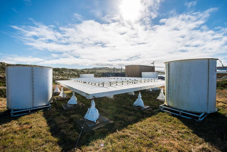
Part of a NOAA/DWR atmospheric river observatory installed at the Bodega Marine Laboratory. DWR/2017.
by Jeanine Jones
We’re hearing this question frequently, and it’s not surprising given California’s dry winter to date. We’d like to know the answer, too.
The National Weather Service’s routine forecasts can only look out about two weeks ahead, and beyond that, there is little reliable skill in predicting precipitation for California.
DWR is working to change that. Over the past decade we’ve made a major investment – in partnership with the National Oceanic and Atmospheric Administration (NOAA) – in a 21st century observing network for extreme precipitation. The network is designed specifically to track the big atmospheric river storms that provide much of California’s water supply. Data from that network, and related research, has greatly improved the understanding of how these big storms behave. Our work over the past decade allows researchers to now move from simply observing these storms, to making experimental forecasts.
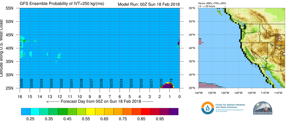
Our research partners at the Center for Western Weather and Water Extremes at the Scripps Institution of Oceanography and the National Aeronautics and Space Administration’s Jet Propulsion Laboratory (JPL) are working to experimentally predict atmospheric river conditions three weeks before they come ashore. The image 'West Coast Atmospheric River Landfall Tool' below from Scripps summarizes the probability of experiencing an atmospheric river storm anywhere on the West Coast during the next 16 days. This example experimental forecast issued Feb. 18 shows no probability of California having one of these storms during the forecast period. This experimental forecasting information is updated daily, and you can check it out at the Center for Western Weather and Water Extremes webpage.
JPL, in collaboration with Scripps, has just begun making preliminary experimental forecasts for DWR that offer 3-week lead times on the probability of atmospheric river conditions. These forecasts use cutting-edge applied research and are testing methods for making longer-term forecasts. They’re not yet expected to produce operational results. Good news, though: the experimental forecasts, to date, have been correct. They’ve successfully predicted the current absence of atmospheric river storms. For example, an early February forecast shows a lower than average chance of an atmospheric river in California, which is exactly what we’re experiencing today.
So, when will it rain again? The simple answer is that we will probably not see big storms through the end of February. Our blocking ridge of high pressure needs to break down before any big storms can visit us.
California’s annual water budget depends on a relatively small number of big storms. From a statewide perspective, we’ve had two so far this winter. Unfortunately, as we transition into spring climate conditions, the probability of having big atmospheric river storms this year lessens. So keep practicing water conservation as a way of life – rain or shine – and know that our experimental forecasting predicts a relatively dry February.

